 CNR-ISMAR
MAELSTROM
Type of resources
Topics
INSPIRE themes
Keywords
Contact for the resource
Provided by
Formats
Representation types
Update frequencies
status
-

Dati acquisiti a Maggio 2023 dal CNR ISMAR VE nell'ambito del progetto MAELSTROM con lo scopo di mappare il marine litter sul fondo
-

Dati acquisiti a dicembre 2023 dal CNR ISMAR VE nell'ambito del progetto MAELSTROM con lo scopo di mappare il marine litter sul fondo
-
-

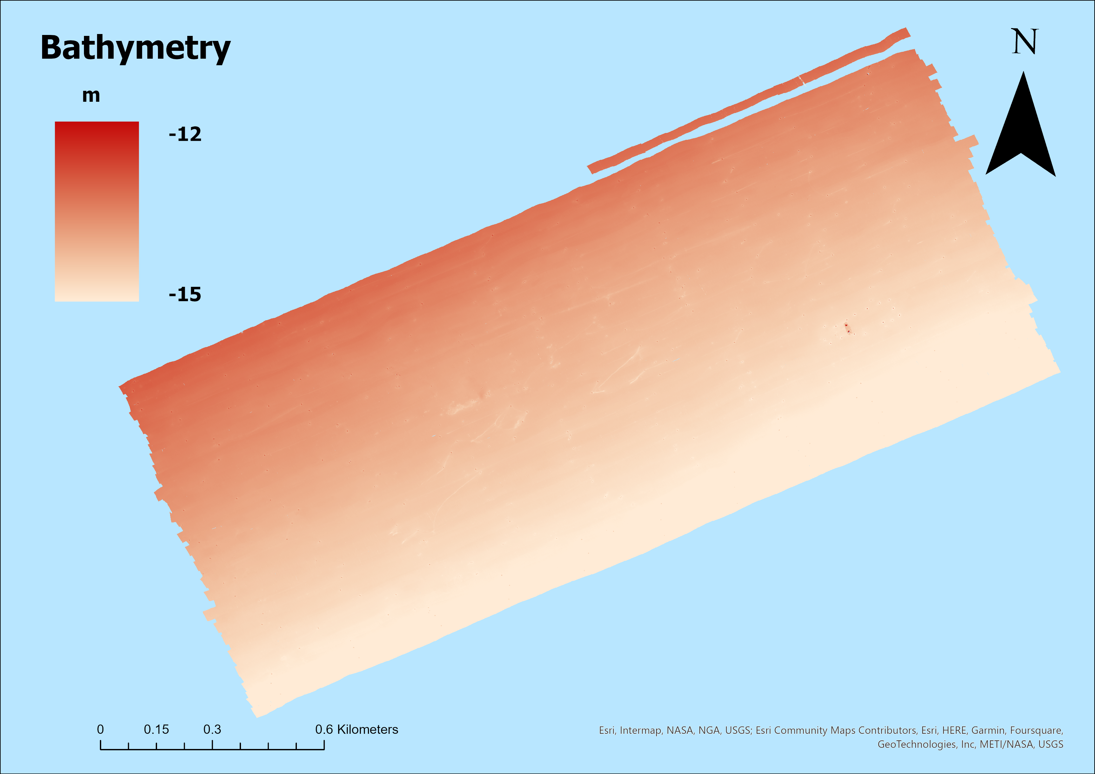
Dati acquisiti in May 2022 dal CNR ISMAR VE nell'ambito del progetto MAELSTROM con lo scopo di mappare il marine litter sul fondo
-

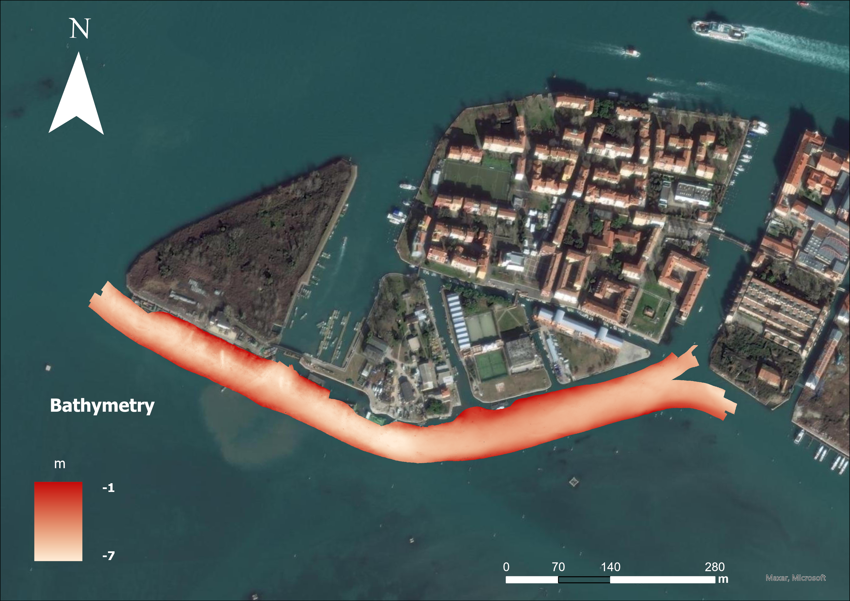
Dati acquisiti a maggio 2023 dal CNR ISMAR VE nell'ambito del progetto MAELSTROM con lo scopo di mappare il marine litter sul fondo
-

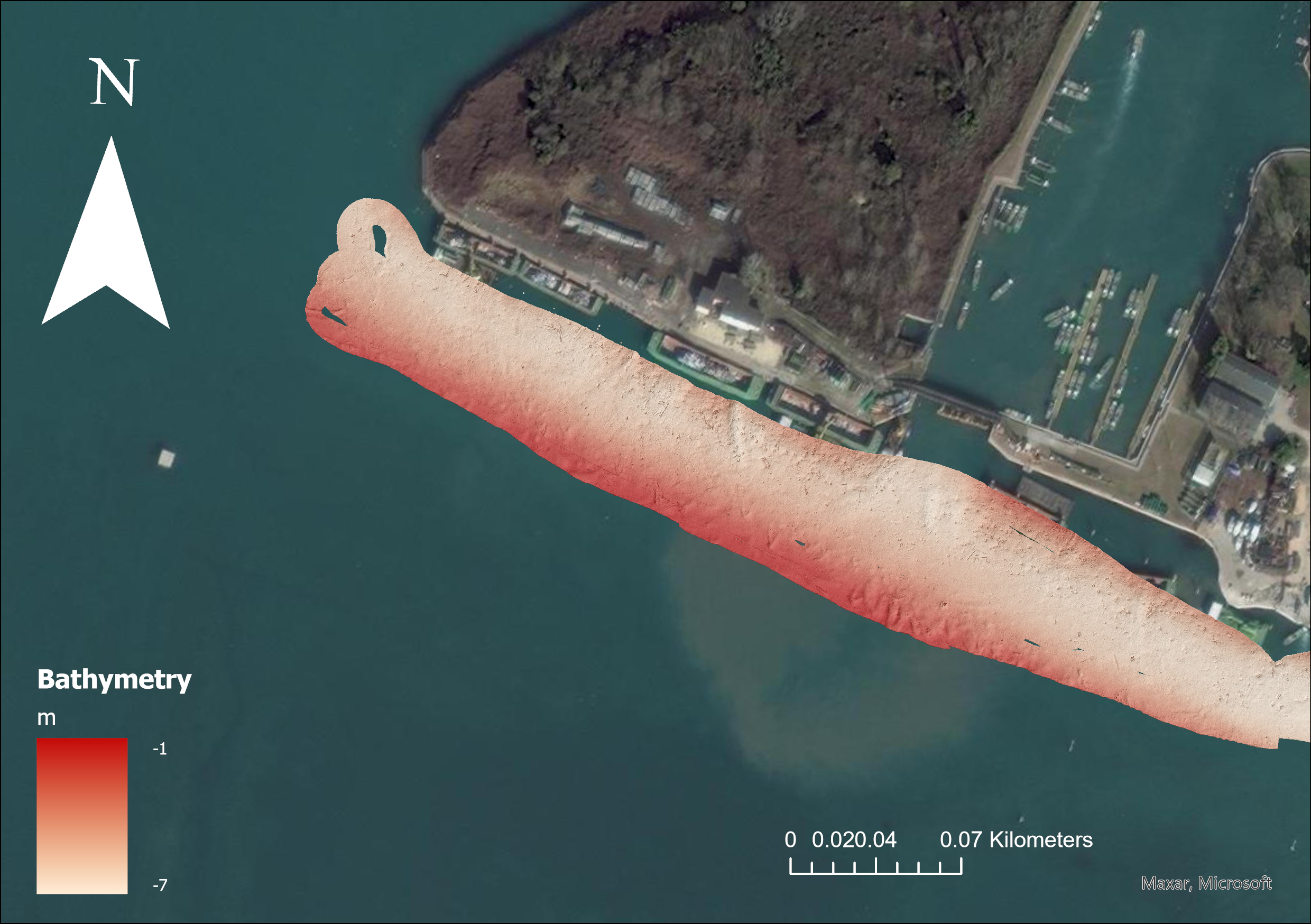
Dati acquisiti a dicembre 2023 dal CNR ISMAR VE nell'ambito del progetto MAELSTROM con lo scopo di mappare il marine litter sul fondo
-
Dati acquisiti in Novembre 2022 dal CNR ISMAR VE nell'ambito del progetto MAELSTROM con lo scopo di mappare il marine litter sul fondo
-
Dati acquisiti in ottobre 2021 dal CNR ISMAR VE nell'ambito del progetto MAELSTROM con lo scopo di mappare il marine litter sul fondo
-
-
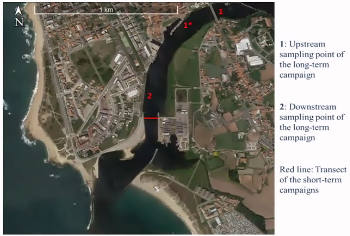
A bubble Barrier that removes litter from rivers is being applied in the Ave estuary (Portugal) in the framework of the MAELSTROM Project. In order to identify the location where the technology could possibly best be applied and to assess the impact of the litter removal on marine life, MAELSTROM makes use of numerical models. Facing the limited field data and absence of available models, we carried out field campaigns, set-up a hydrological model for the Ave river basin and set-up a hydrodynamic model for the estuarine region. The field studies included a bathymetric survey, short-term (12.5 hours) and long-term (several weeks) campaigns. Aiming to understand the temporal and spatial variation of the flow velocity in the estuary, and particularly in the area where the Bubble Barrier system is planned to be implemented, we have analysed observations from a boat sailing across the estuary (short-term), we have analysed observations at selected locations (long-term) and we have set-up a 3-dimensional (3D) hydrodynamic model to give insight in the flow velocity distribution. Only during the short-term campaigns the river discharge is known, which was relatively low during these campaigns. Since the river discharge is an important condition for the hydrodynamic model, we have only obtained maximal flow velocity maps for low river discharge. For higher river discharge we show a maximal flow velocity observed during a long-term campaign and we estimate maximal flow velocity based on an extreme river discharge.