 CNR-ISMAR
shapefile
Type of resources
Available actions
Topics
INSPIRE themes
Provided by
Years
Formats
Representation types
Update frequencies
status
-
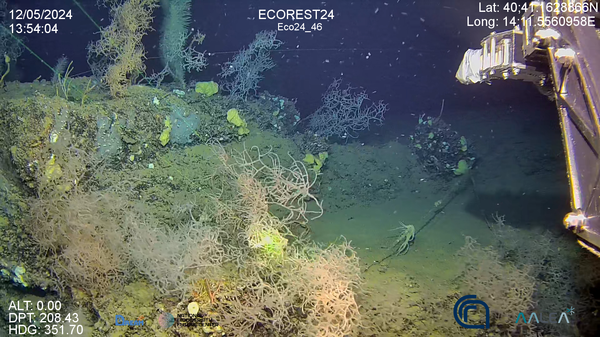
High resolution video on back corals forest in the Gulf of Naples (Italy)
-
Video footage of the seabed recorded by drop-frame in the Treporti Channel (1.6 km2), the Burano Channel (1.56 km2), the San Felice Channel (0.82 km2) and minor channels namely Scanello, San Antonio, Gaggian, and Riga channels, covering a total area of 4.45 km2. The surveyed channels are in the northern part of the Lagoon.
-

Il dataset descrive la distribuzione degli habitat marini d'interesse comunitario (sensu Direttiva 92/43/CEE) all'interno delle Zone Speciali di Conservazione (ZSC) lungo le coste del Lazio La pubblicazione di riferimento è Ardizzone G., Belluscio A e Criscoli A., 2018. Atlante degli habitat dei fondali marini del Lazio. Sapienza Università Editrice.
-
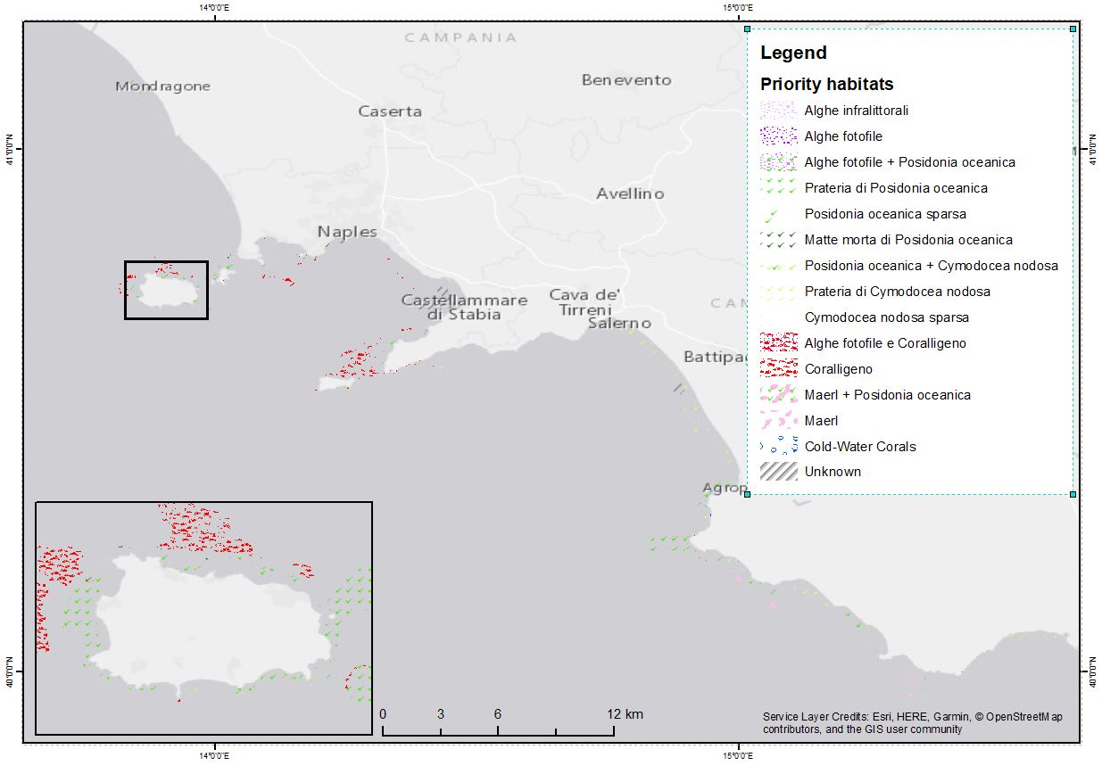
The shapefile contains the priority habitats of the Campania Region (inside 24 NM) produced in the framework of the FEAMP-ISSPA Project by CNR-ISMAR. It is the results of a bibliographic review coupled with new data (FEAMP-ISSPA) and recovered geophysics data collected by CNR-ISMAR through the years. The shapefile includes coralligenous, maerl, Posidonia oceanica, Cymodocea nodosa, photophilic algae, bioconstructions, and cold-water corals.
-
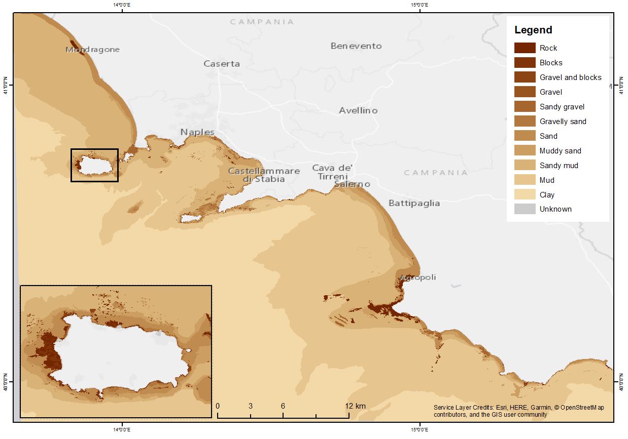
The shapefile contains the marine substrates of the Campania Region (inside 24 NM) produced in the framework of the FEAMP-ISSPA Project by CNR-ISMAR starting from the CARG cartography and the EUSeaMap from EMONnet.
-
L'atlante fornisce una base conoscitiva naturalistica dei fondali marino-costieri, dei loro principali popolamenti, fra i quali le praterie di Posidonia oceanica ed il Coralligeno. Il rilevamento dei dati cartografati tramite interpretazione di repertorio aerofotogrammetrico, di mappatura acustica con tecnica side scan sonar e di morfobatimetrica di dettaglio con tecnica multibeam, è integrato da materiale bibliografico scientifico di settore e dalle banche dati di Regione e Arpal. Il riferimento cartografico a terra è la CTR 1:10000. Il livello è un aggiornamento della mappatura allegata alla pubblicazione Atlante degli Habitat Marini della Liguria (Diviacco/Coppo-2006), così come approvato con D.G.R.n.141 del 28/02/2020.
-
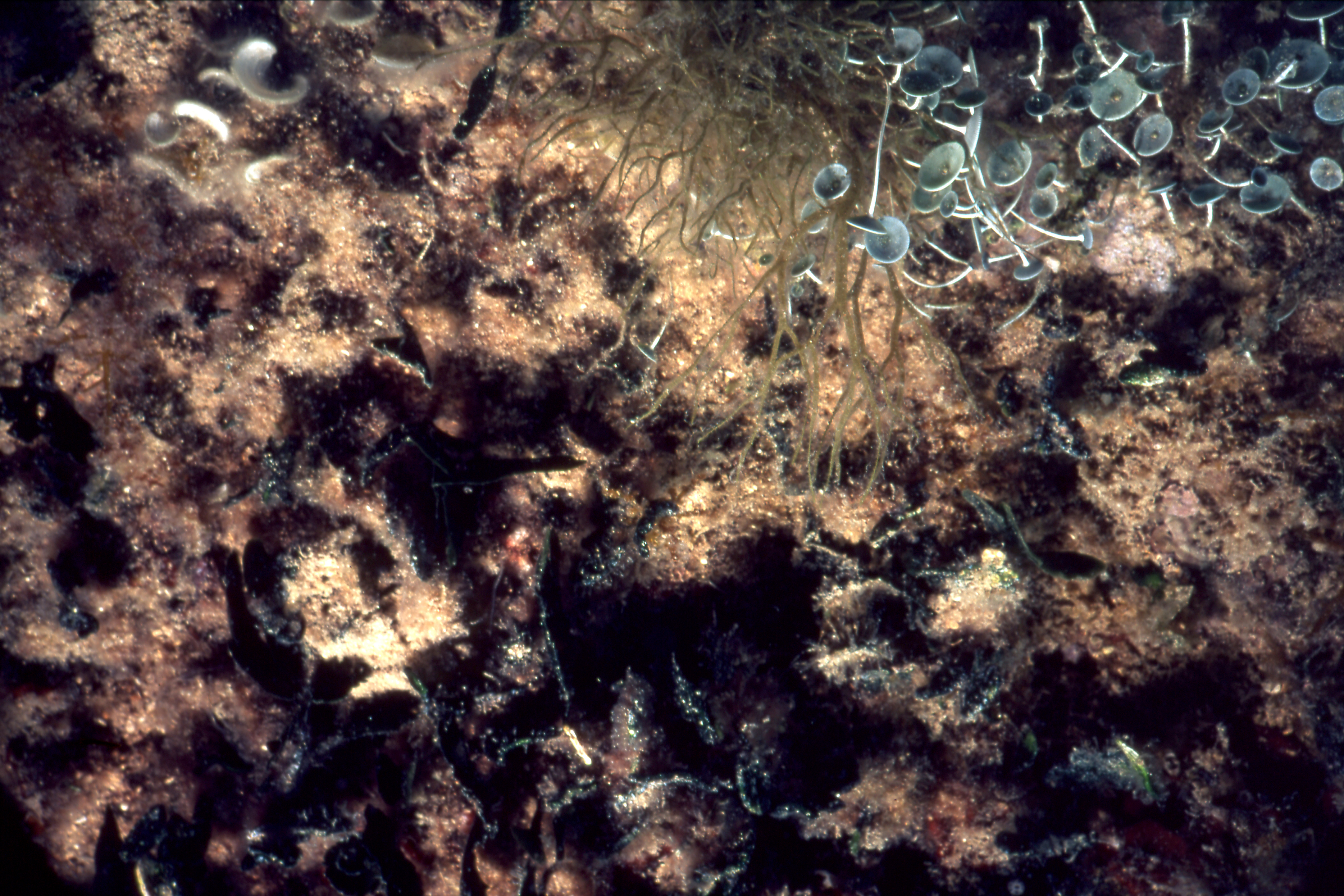
Evaluation of the effectiveness of Italian MPAs: the dataset consists of images from the digitization of the 2001 slides, taken during the project AFRODITE
-
to be filled..
-

High resolution image of the rocky benthic assemblages for the MPAs of Ventotene, Punta Campanella, Porto Cesareo, Torre Guaceto
-
to be filled..