 CNR-ISMAR
Format
Web Map Service
Type of resources
Available actions
Topics
INSPIRE themes
Provided by
Years
Formats
Representation types
Update frequencies
status
Scale
From
1
-
10
/
63
-
to be filled..
-
Digital Elevation Model (DEM) at 102x102 meters cell resolution showing the topography and the water depth of the CORSUB study area.
-
Digital Elevation Model (DEM) with a 15x15 meters cell resolution showing the topography and the water depth of the study area.
-
to be filled..
-
to be filled..
-
to be filled..
-
to be filled..
-
to be filled..
-

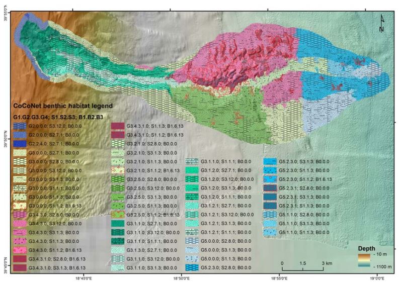
Substrate of the benthic habitat map of the Campania Region produced in the framework of the FEAMP-ISSPA Project by CNR-ISMAR
-
Type of substrate characterizing the seabed (i.e. rock, sand, pelite).