 CNR-ISMAR
Shapefile
Type of resources
Available actions
Topics
INSPIRE themes
Keywords
Contact for the resource
Provided by
Years
Formats
Representation types
Update frequencies
status
Scale
-
Bibliographic review collecting studies carried out at Tremiti Islands. This work has been done in the scope of "AMP Tremiti contabilità ambientale II" project commissioned to CoNISMa (Consorzio Nzionale Interuniversitario per le Scienze del Mare) by Ente Parco Nazionale del Gargano. This dataset aim to provide a comprehensive collection of all scientific research done in the specific area of Tremiti Islands. The research was performed across multiple search engines, namely Google scholar, Scopus and Web of Science with defined queries. All results were examinated further and only papers that provided geographical coordinates (or a map) (WIP)
-
Carota di sedimento "AR16-02" collezionata durante la campagna oceanografica "AR16" dal CNR-ISMAR in nord Adriatico (elevation 39.05 m; core size: 5 m; core sections: xx; core section halfs: xx)
-
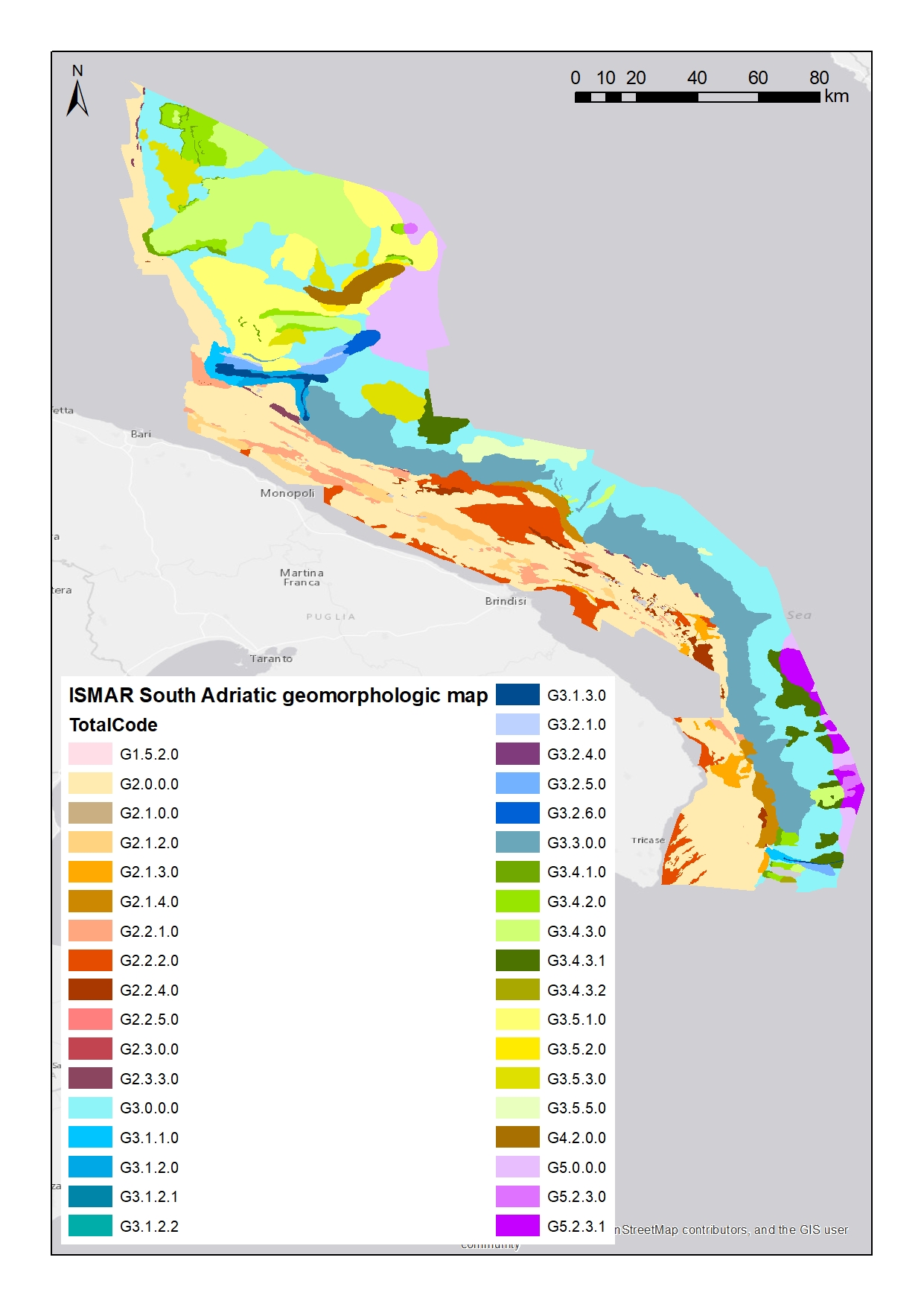
Shapefile del solo livello 2. Livello 2: Unità Morfologiche (UM) Rappresentano grandi unità all'interno delle quali si raggruppano tratti morfologici (EM del Livello 3) anche diversi ma la cui predominanza è caratterizzante e indicativa di determinati processi o fenomeni geologici. Scheda metadati originale: http://dati.protezionecivile.it/geoportalDPC/catalog/search/resource/details.page?uuid=PCM_MaGIC1_17%3A20160627%3A125032
-
da compialre..
-
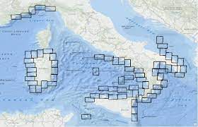
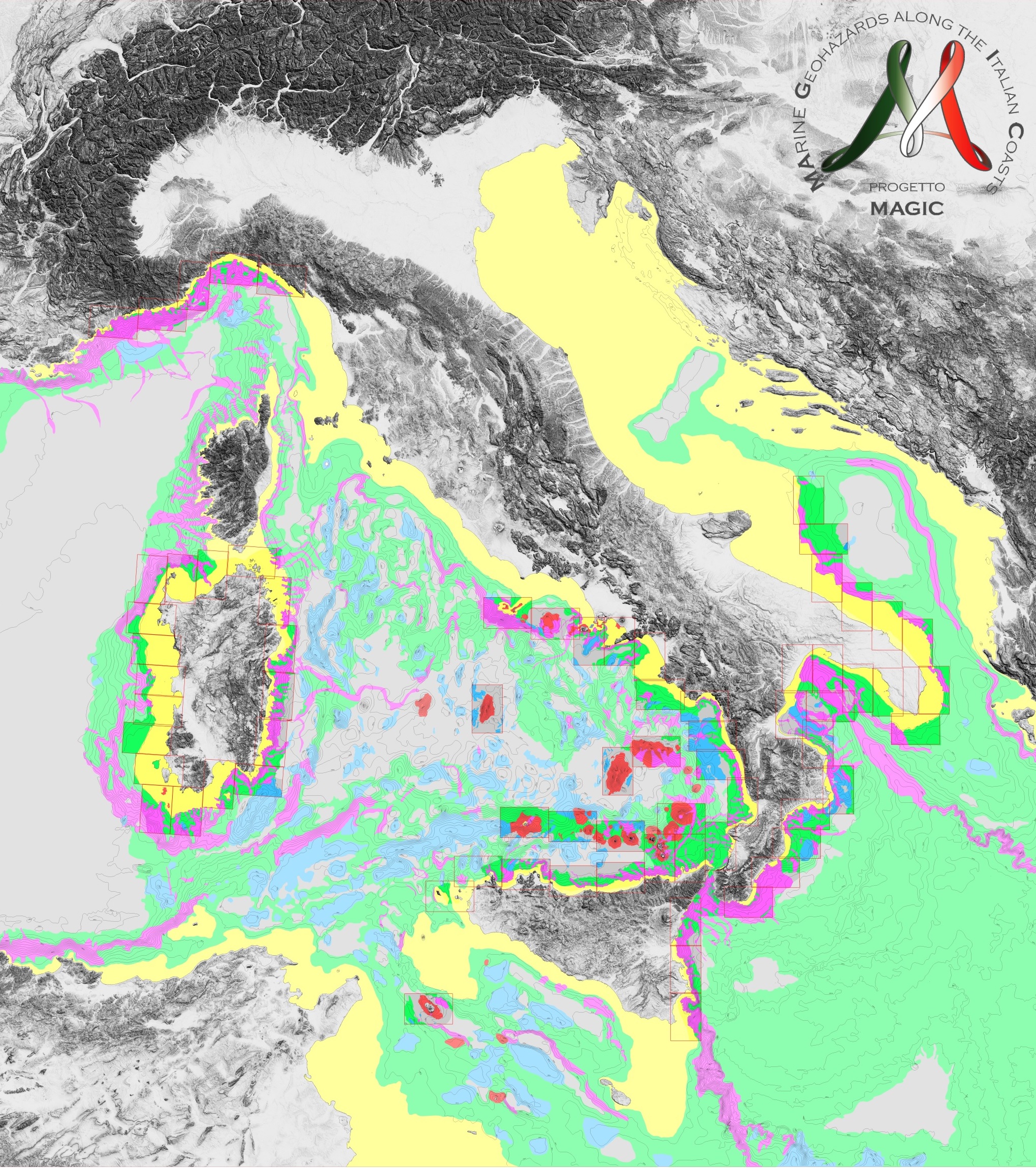
Quadro di unione dei 72 fogli che costituiscono la cartografia prodotta nell'ambito del Progetto MArine Geohazards along the Italian Coasts realizzato dai gruppi di ricerca italiani attivamente impegnati nel campo della Geologia Marinacon la partecipazione anche di un’unità dell’Università di Nizza. Alle 72 mappe, l'Università di Nizza ha aggiunto un'altra carta, relativa alla sua zona di sperimentazione. Scheda metadati originale: http://dati.protezionecivile.it/geoportalDPC/catalog/search/resource/details.page?uuid=PCM_MaGIC1_01%3A20160704%3A081100
-
nessuno
-
nessuno
-
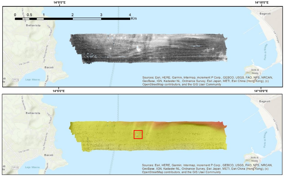
Nell’ambito del progetto FEAMP ISSPA (Linea 1.4 e Linea 2.51) è stato effettuato un rilievo Multi Beam allo scopo di indagare i fondali relativi alle aree identificate come potenzialmente idonee all’acquacultura. Tali rilievi hanno lo scopo di completare la mappa degli habitat bentonici e delle caratteristiche fisiche del substrato necessario alla corretta pianificazione spaziale marittima e all’identificazione delle pressioni multiple all’interno dell’area marina protetta Regno di Nettuno e del Sito Natura 2000 Fondali marini di Ischia Procida e Vivara. Il rilievo è stato effettuato con Multi Beam Knosgber 2040 C e Seapath 130-J. Sono state effettuate sonde per il profilo di velocità dell’acqua circa 2 volte al giorno con Mini SVP Valeport. È stata effettuata la calibrazione dello strumento all’inizio del rilievo e sono stati corretti i parametri di pitch, yaw a roll. L’elaborazione preliminare dei dati è stata effettuata a bordo con il software CARIS HIPS and SIPS ed è stato prodotto un DTM e un mosaico della riflettività a 1 m di risoluzione per tutta l’area indagata. Le mappe sono state estituite con il software ArcGIS 10.8.
-
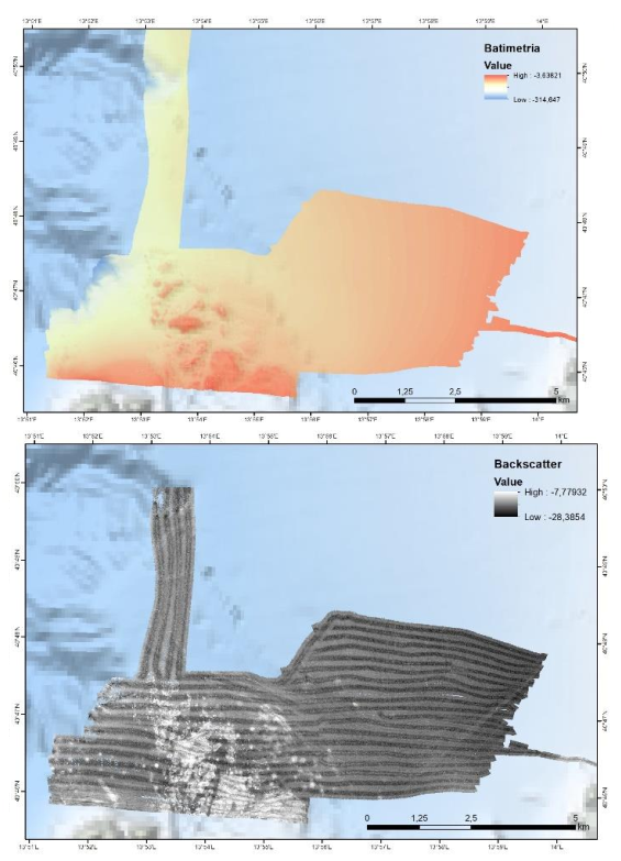
Nell’ambito del progetto FEAMP ISSPA (Linea 1.4 e Linea 2.51) è stato effettuato un rilievo Multi Beam allo scopo di indagare i fondali relativi alle aree identificate come potenzialmente idonee all’acquacultura. Tali rilievi hanno lo scopo di completare la mappa degli habitat bentonici e delle caratteristiche fisiche del substrato necessario alla corretta pianificazione spaziale marittima e all’identificazione delle pressioni multiple all’interno dell’area marina protetta Regno di Nettuno e del Sito Natura 2000 Fondali marini di Ischia Procida e Vivara. Il rilievo è stato effettuato con Multi Beam Knosgber 2040 C e Seapath 130-J. Sono state effettuate sonde per il profilo di velocità dell’acqua circa 2 volte al giorno con Mini SVP Valeport. È stata effettuata la calibrazione dello strumento all’inizio del rilievo e sono stati corretti i parametri di pitch, yaw a roll. L’elaborazione preliminare dei dati è stata effettuata a bordo con il software CARIS HIPS and SIPS ed è stato prodotto un DTM e un mosaico della riflettività a 1 m di risoluzione per tutta l’area indagata. Le mappe sono state estituite con il software ArcGIS 10.8.
-
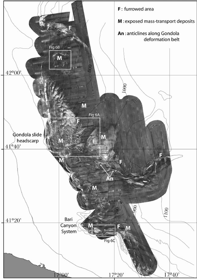
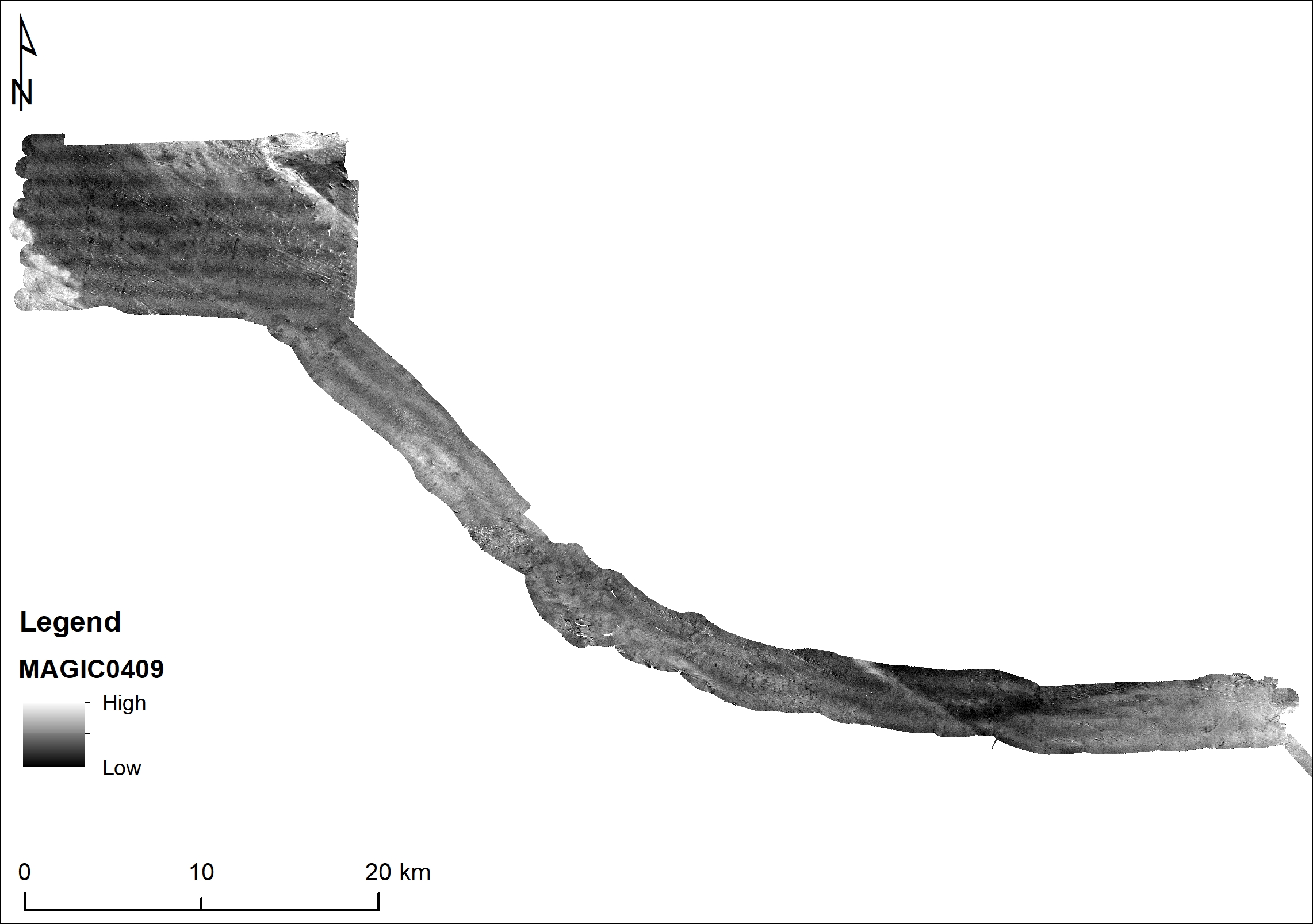
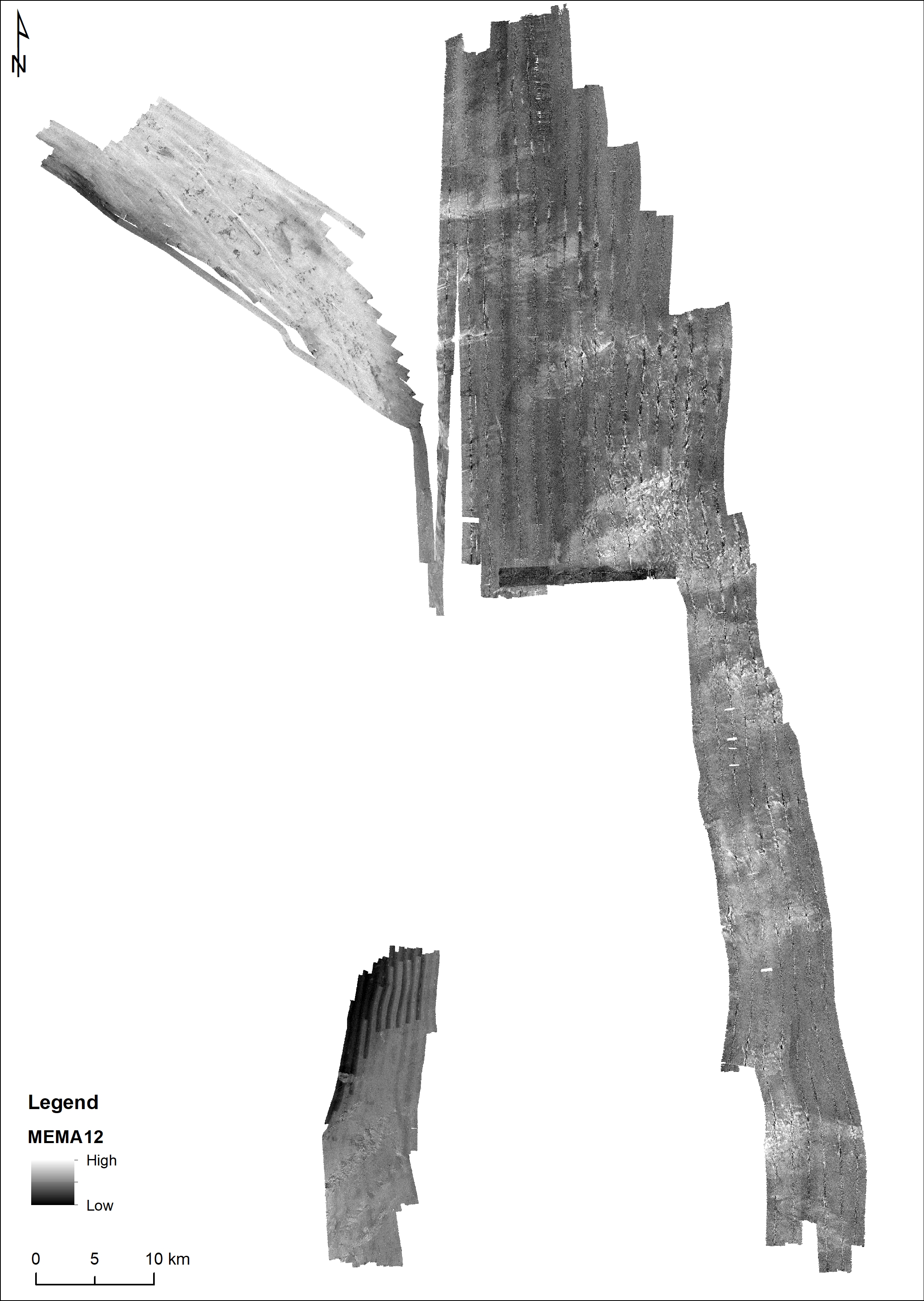
Mosaico da side-scan sonar TOBI a 30-kHz con informazioni circa la riflettività del fondale e la macro morfologia. I dati sono stati collezionati durante la campagna oceanografica SAGA-03 nell'ambito del progetto europeo EUROSTRATAFORM (EC contract no. EVK3-CT-2002-00079) e processati dal “National Oceanographic Center, Southampton” seguendo il metodo proposto da Le Bas et al. (1995)