 CNR-ISMAR
denominator
2000
Type of resources
Topics
INSPIRE themes
Provided by
Years
Formats
Representation types
Scale
Resolution
From
1
-
1
/
1
-
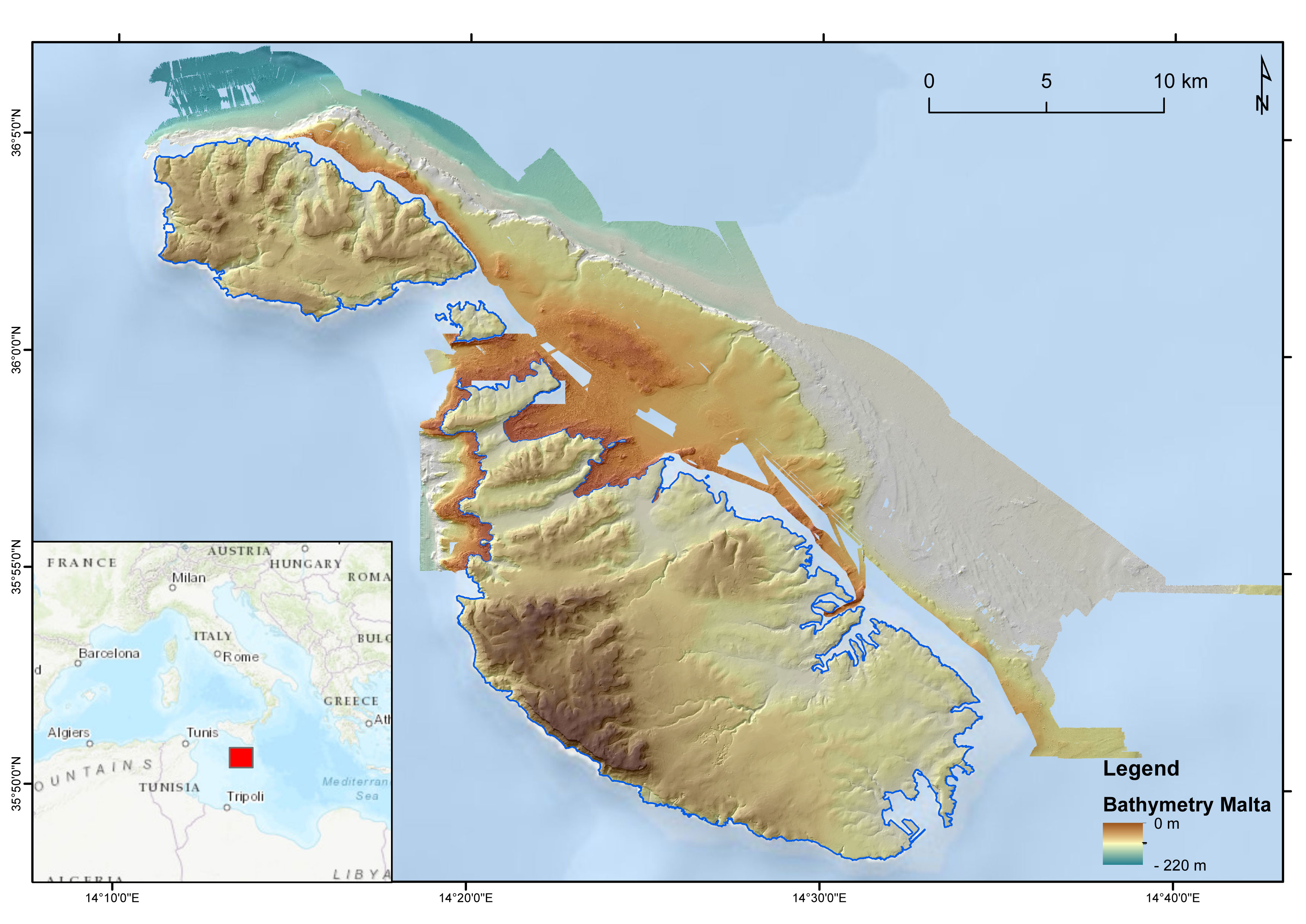
DTM of the Maltese seafloor resulting from the merge of 3 MBES-derived DTMs (cruises MEDCOR, DECORS and MAPSCAPE) and a bathymetric LiDAR-derived DTM (ERDF20112). Horizontal resolution of 2 m. It comprises the seabed offshore N Gozo, E Maltese Islands and NW Malta. The DTM refers to the following CDIs: 145_CNR-ISMAR-125, MAPSCAPE2012, 145_CNR-ISMAR-126, ERDF_LIDAR_2012