 CNR-ISMAR
2023
Type of resources
Topics
INSPIRE themes
Provided by
Years
Formats
Representation types
Update frequencies
status
-
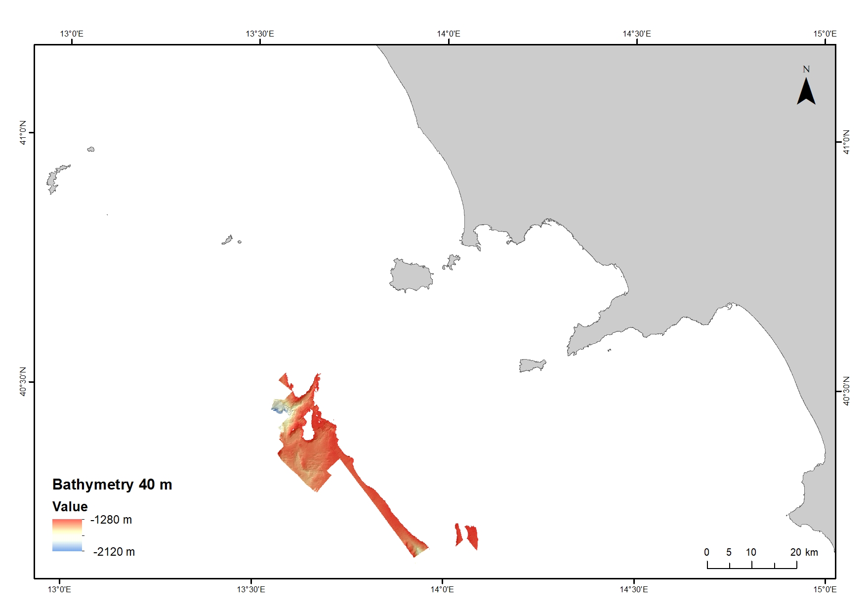
Digital Elevation Model (DEM) from 1280 to 2120 water depth at 40 meters resolution. Bathymetric surface collected during the oceanographic cruise JAMMEGAIA22 on board of the R/V GAIA BLU by CNR.
-
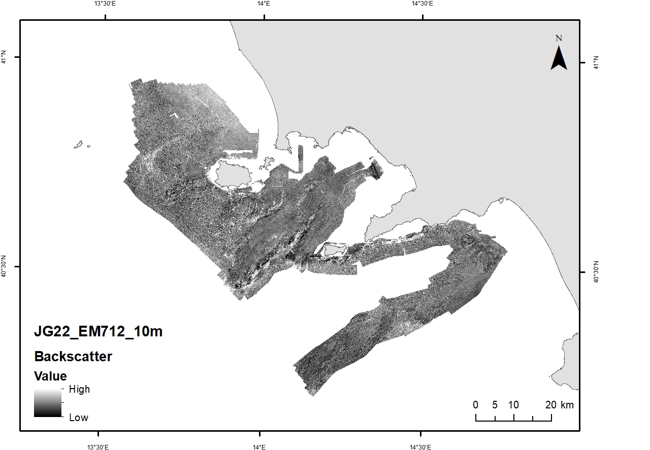
Acoustic reflectivity data (multi beam backscatter) collected during the oceanographic cruise JAMMEGAIA22 on board of the R/V GAIA BLU by CNR.
-
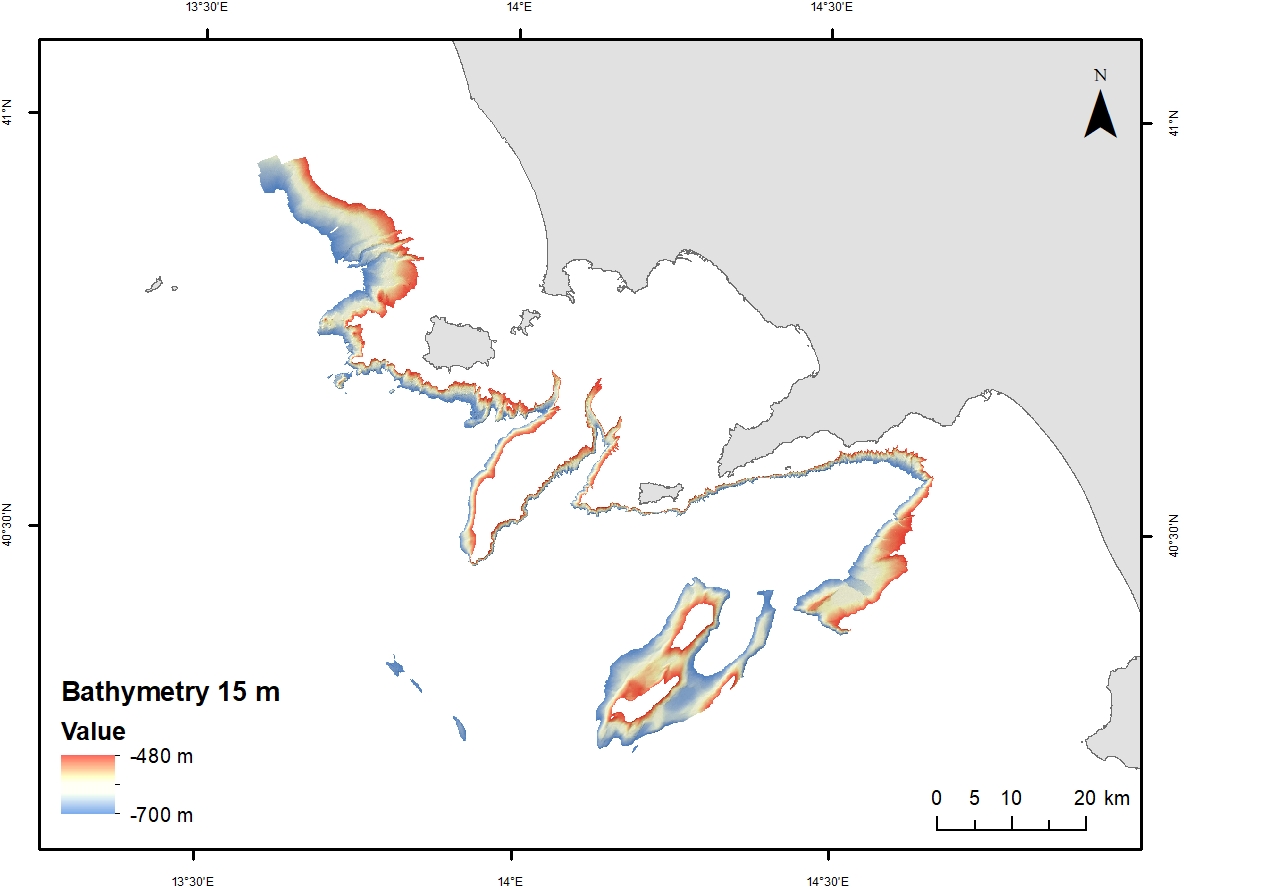
Digital Elevation Model (DEM) from 480 to 700 m waters depth with a spatial resolution of 15 m. Bathymetric surface collected during the oceanographic cruise JAMMEGAIA22 on board of the R/V GAIA BLU by CNR.
-
Data collected in April 2023 by CNR- ISMAR VE within the MAELSTROM project with the aim to map marine litter on the seafloor
-
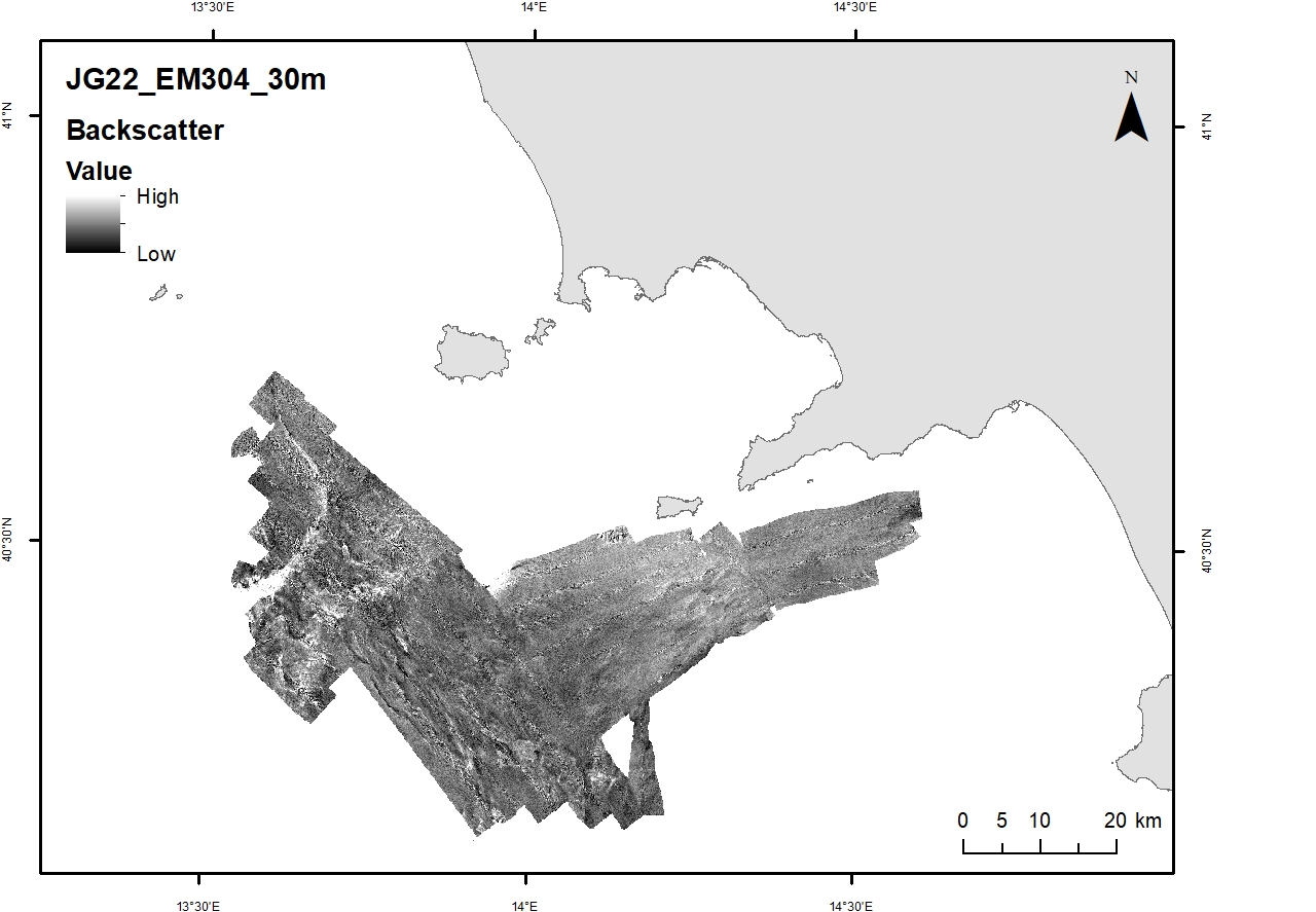
Acoustic reflectivity data (multi beam backscatter) collected during the oceanographic cruise JAMMEGAIA22 on board of the R/V GAIA BLU by CNR.
-
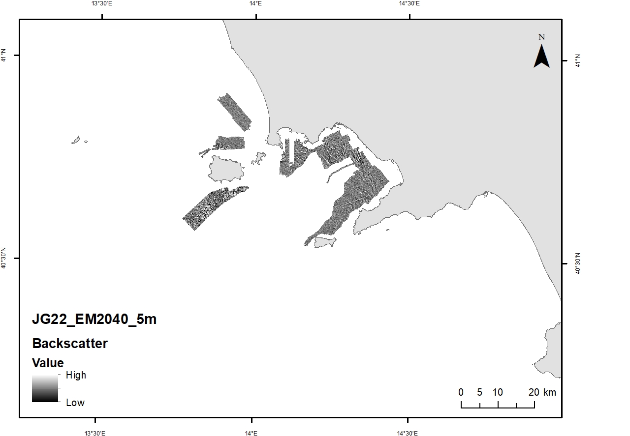
Acoustic reflectivity data (multi beam backscatter) collected during the oceanographic cruise JAMMEGAIA22 on board of the R/V GAIA BLU by CNR.
-
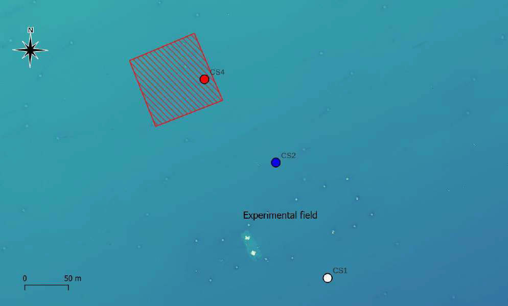
Soft bottom macrozoobenthic communities were characterized in Mussel Farm. In the marine site, three stations were defined: CS1 (planned cleaning area and discontinued in September 2023), CS2 (control) and CS4 (cleaning area since september 2023). The protocol includes sampling by Van Veen grab (surface area of 0.1 m2, volume of approx. 17 L), taxonomic determination and quantitative analysis of the community matrix.
-
Data collected in April 2023 by CNR- ISMAR VE within the MAELSTROM project with the aim to map marine litter on the seafloor
-
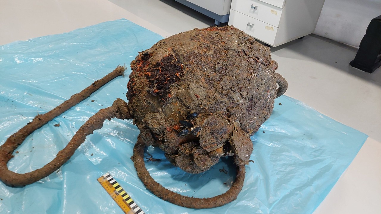
During the marine litter cleanup activities at the Mussel Farm site, fouling organisms were sampled from a subset of the collected litter items. From each item, a 0.1 m² area was scraped from the surface exposed to epifaunal colonization. In the coastal site, samples of sufficient quality could be acquired during May-June 2023 cleaning operations, 2 plastic buoys retained near the seabed and a section of synthetic rope, all of them leftover aquaculture equipment.
-
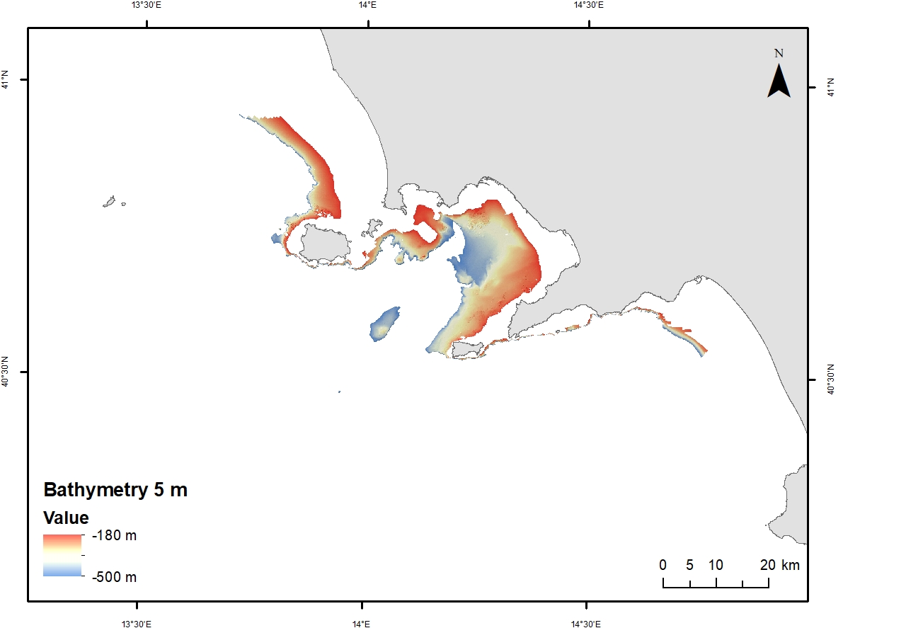
Digital Elevation Model (DEM) from 100 to 200 m water depth with a spatial resolution of 5 m. Bathymetric surface collected during the oceanographic cruise JAMMEGAIA22 on board of the R/V GAIA BLU by CNR.