 CNR-ISMAR

Type of resources
Available actions
Topics
INSPIRE themes
Provided by
Years
Formats
Representation types
Scale
Resolution
-
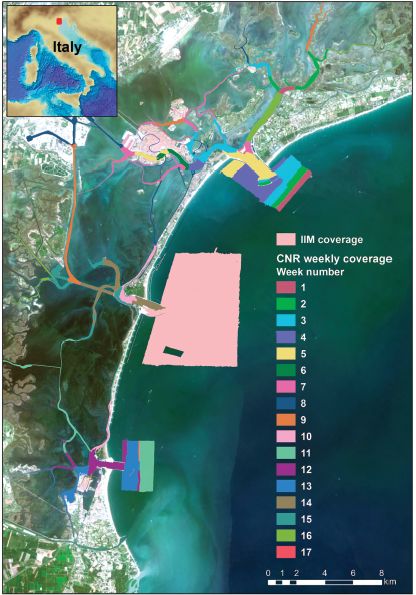
The multibeam data were collected during six-months in 2013 with a Kongsberg EM2040 compact dual-head multi-frequency system. Metadata for the 17-week-long survey is available from the Seadatanet catalogue CDIs: 145_CNR-ISMAR-102,145_CNR-ISMAR-103,145_CNR-ISMAR-104,145_CNR-ISMAR-105,145_CNR-ISMAR-106,145_CNR-ISMAR-107,145_CNR-ISMAR-108,145_CNR-ISMAR-109,145_CNR-ISMAR-110,145_CNR-ISMAR-111,145_CNR-ISMAR-112,145_CNR-ISMAR-113,145_CNR-ISMAR-114,145_CNR-ISMAR-115,145_CNR-ISMAR-116,145_CNR-ISMAR-117,145_CNR-ISMAR-118.
-
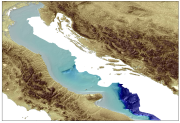
Bathymetry of the central-southern Tyrrhenian Sea compiled by CNR-IGAG in order to illustrate the main geological features of the italian margin using multibeam echosounder.
-
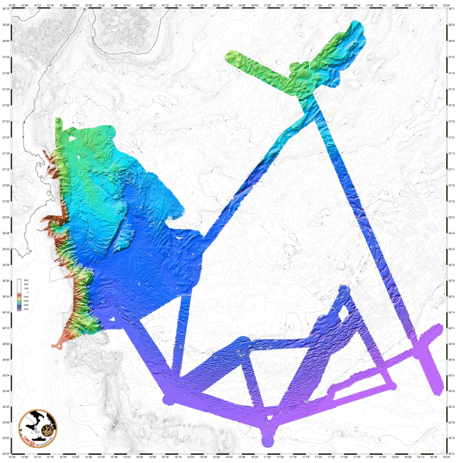
A major objectiv of the cruise as the identification of active faults by bathymetric mapping and HR and VHR (Chirp) seismic profiles, as well as chronology of major historic quakes by dating of turbidites.
-
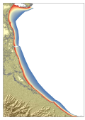
Digital bathymetric model in grid format. The product represents the bathymetry using a model cell that is associated with regular information on the depth of the Adriatic Sea in front of the Emilia Romagna Region.
-
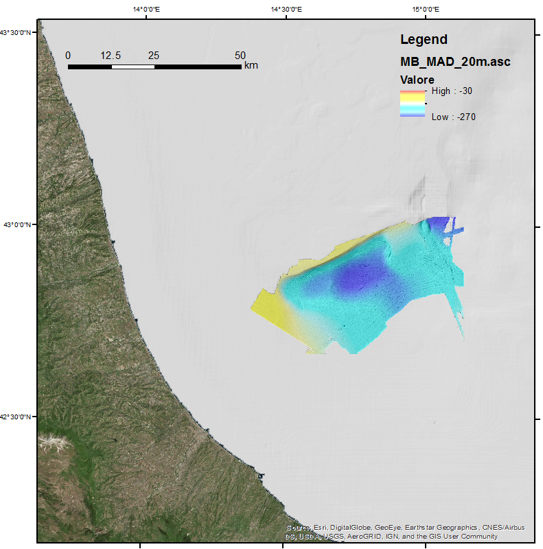
This DTM is the result of merging of two multibeam surveys identified by their CDIs names and short dataset names: 145_145_CNR-ISMAR-50,MADGAS 145_145_CNR-ISMAR-65,MADMAP12. These data were acquired with a Kongsberg EM710 multibeam system.
-
Bathymetry of the Adriatic Sea compiled by CNR-ISMAR for the Italian side of the Adriatic Sea to illustrate the main geological features of the Western Adriatic Basin using a single beam echosouder.
-
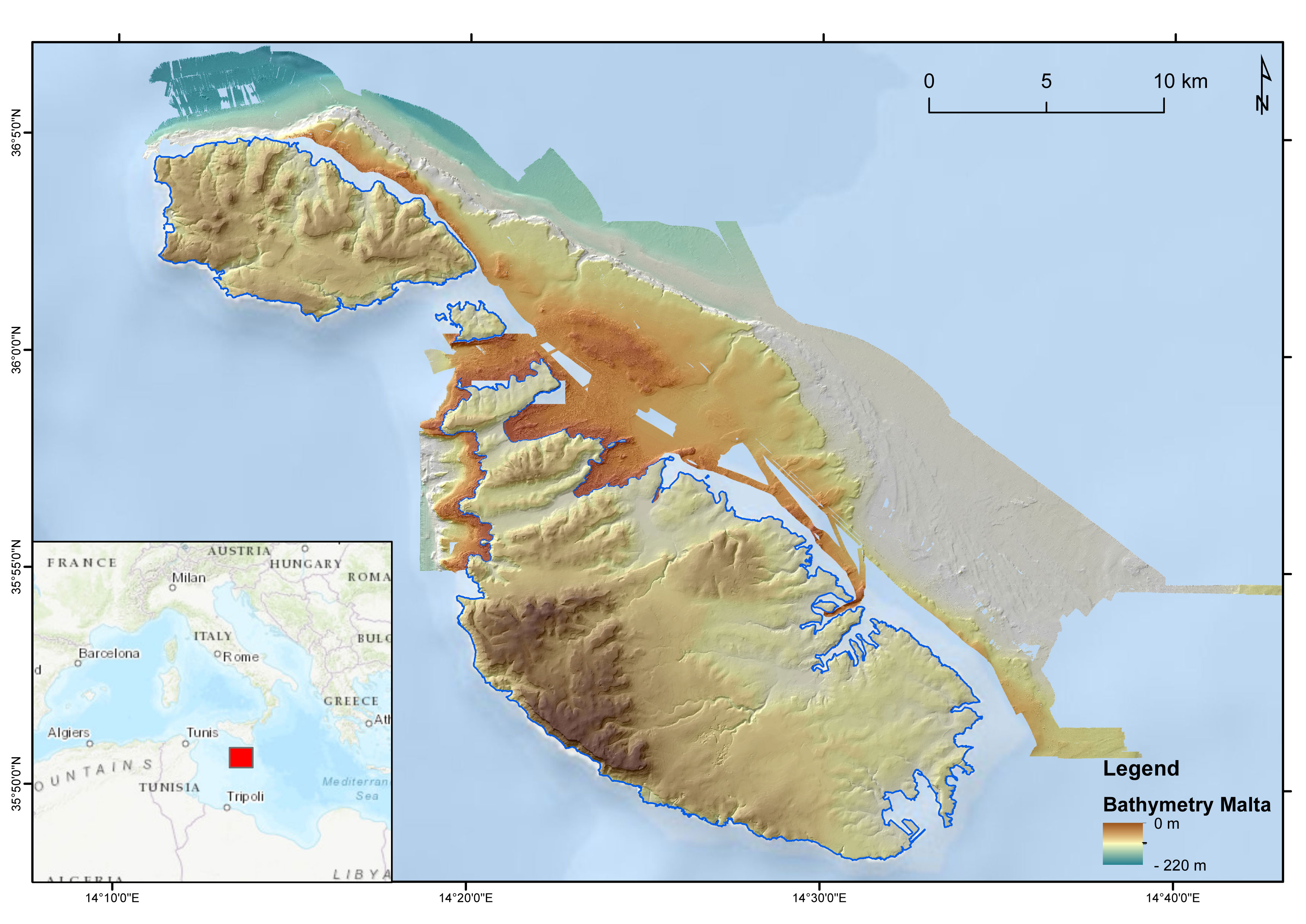
DTM of the Maltese seafloor resulting from the merge of 3 MBES-derived DTMs (cruises MEDCOR, DECORS and MAPSCAPE) and a bathymetric LiDAR-derived DTM (ERDF20112). Horizontal resolution of 2 m. It comprises the seabed offshore N Gozo, E Maltese Islands and NW Malta. The DTM refers to the following CDIs: 145_CNR-ISMAR-125, MAPSCAPE2012, 145_CNR-ISMAR-126, ERDF_LIDAR_2012
-
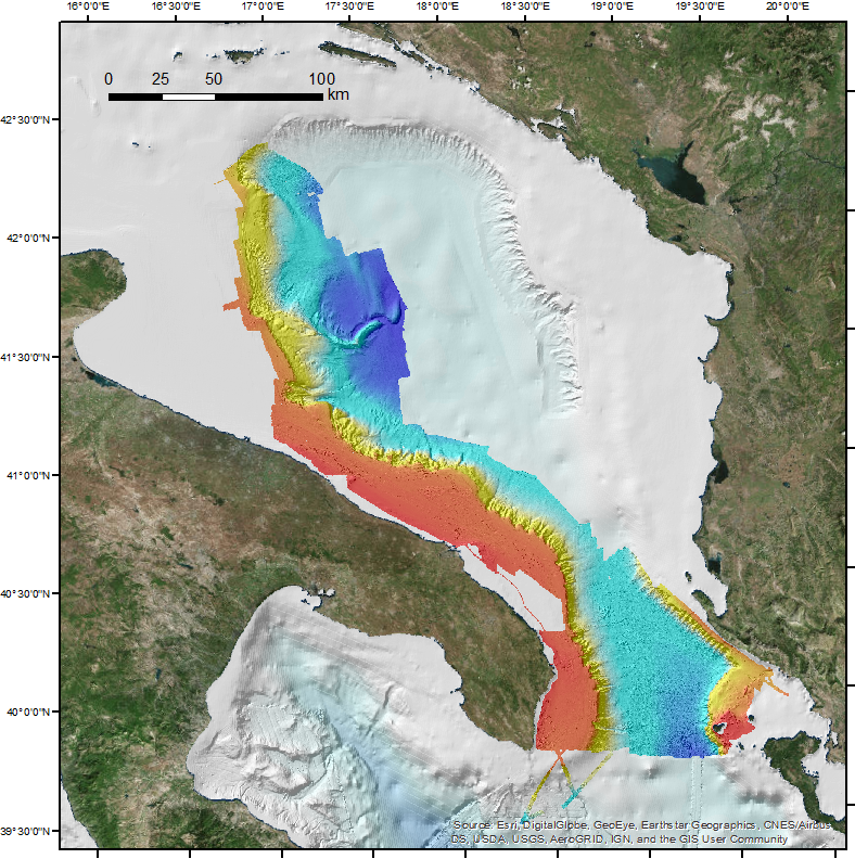
This DTM is the result of merging of several multibeam surveys identified by their CDIs names and short dataset names: 145_CNR-ISMAR-06, STRATA05;145_CNR-ISMAR-07,SETE06;145_CNR-ISMAR-08,BARCA07;145_CNR-ISMAR-09,SASSI08;145_CNR-ISMAR-10,IMPACT09;145_ CNR-ISMAR-11,MAGIC0409;145_CNR-ISMAR-12,ARCADIA;145_CNR-ISMAR-13,ARCO;145_145_CNR-ISMAR-44,RISA09;145_145_CNR-ISMAR-45, SOM09;145_145_CNR-ISMAR-46,MAGIC0709-ADRIA;145_145_CNR-ISMAR-47,MAGIC0910;145_145_CNR-ISMAR-48,MAGIC0211;145_145_ CNR-ISMAR-49,OBAMA;145_145_CNR-ISMAR-52,MEMA12;145_145_CNR-ISMAR-62,COCOMAP13;145_145_CNR-ISMAR-74,COCOMAP14.