 CNR-ISMAR
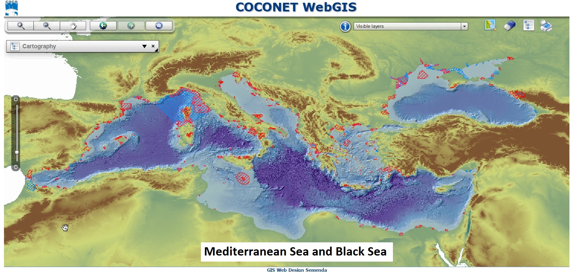
CoCoNet WebGIS
Geoportal implemented in the framework of the CoCoNet Project to manage multidisciplinary spatial data at Mediterrnean Sea and Black Sea scales
Simple
- Date (Creation)
- 2022-08-10
- Presentation form
- Digital map
- Credit
- © CNR-ISMAR
- Status
- On going
Originator
National Research Council - Institute of Marine Science (CNR-ISMAR)
-
Valentina Grande
(
Technologist
)
https://orcid.org/0000-0002-3489-268X
- Maintenance and update frequency
- As needed
- Keywords
-
- webgis
- geoportal
- coconet project
- mediterranean sea
- black sea
- GEMET - INSPIRE themes, version 1.0
-
- Protected sites
- Habitats and biotopes
- Energy resources
- Use limitation
- none
- Access constraints
- Intellectual property rights
- Other constraints
- free access
Resource constraints
No information provided.
- Use constraints
- Intellectual property rights
- Other constraints
- CC-BY
- Classification
- Unclassified
- Metadata language
- English
- Topic category
-
- Oceans
- Environment
- Biota
- Description
- mediterranean basin; black sea
N
S
E
W
))
- Supplemental Information
- none
- Distribution format
-
-
html5 web application
(
html5
)
-
html5 web application
(
html5
)
Distributor
National Research Council - Institute of Marine Science (CNR-ISMAR)
-
Director
(
Director
)
- OnLine resource
- Web page ( WWW:LINK-1.0-http--link )
- Hierarchy level
- Non geographic dataset
- Other
- Web application
Conformance result
- Date (Revision)
- 2020-10-09
- Explanation
- Validated in Geonetwork according to the ISO19115 rules (24/24)
- Pass
- Yes
- File identifier
- ed24ce5d-d887-4eab-9120-560363681002 XML
- Metadata language
- English
- Character set
- UTF8
- Hierarchy level
- Non geographic dataset
- Hierarchy level name
- Web application
- Date stamp
- 2022-08-12T16:02:40
- Metadata standard name
- ISO 19115:2003/19139
- Metadata standard version
- 1.0
Overviews
Spatial extent
N
S
E
W
Provided by

Associated resources
Not available