CNR-ISMAR
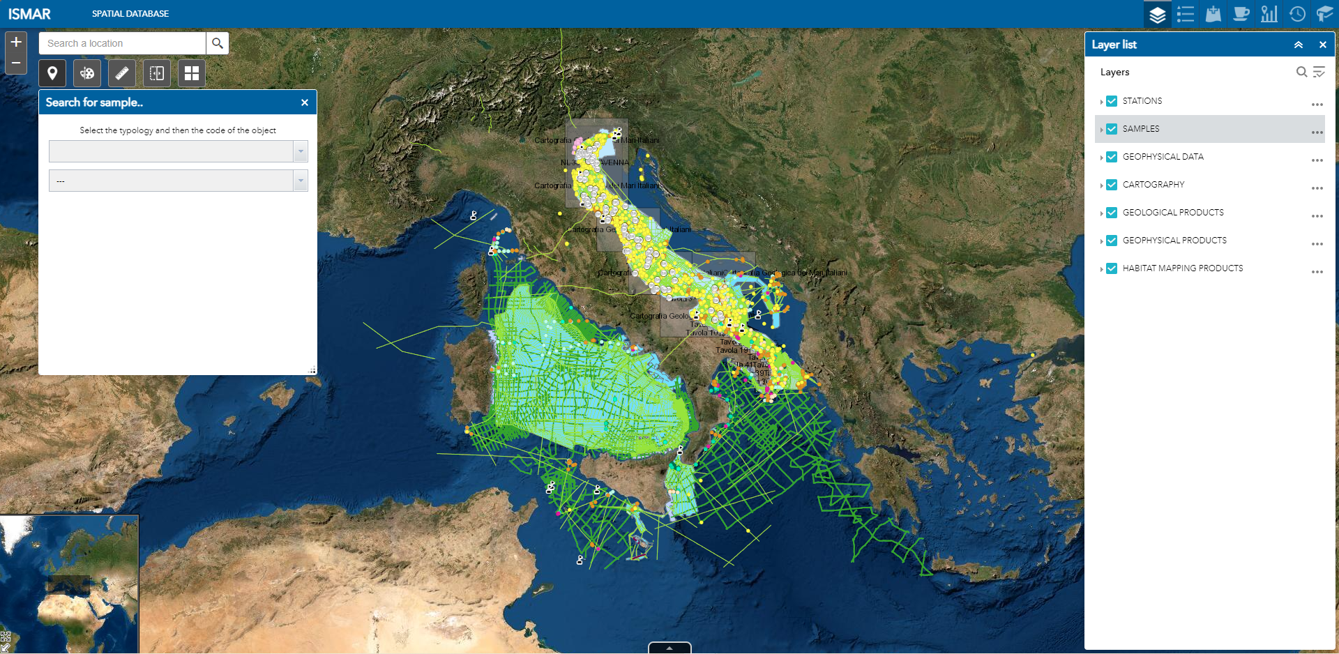
ISMAR Seamap Explorer
WebGIS implemented to preserve, integrate and share spatial data and products produced by ISMAR and ISP in the last decades
Base
- Data (Creazione)
- 2022-08-10
- Identificatore
- http://libeccio.bo.ismar.cnr.it:8080/geonetwork/srv/eng/catalog.search#/metadata/df1ef2f2-1558-49cd-8dca-3f3de047ddfd
- Formato di presentazione
- Mappa digitale
- Crediti
- © CNR-ISMAR
- Status
- Completato
Ideatore
National Research Council - Institute of Marine Science (CNR-ISMAR)
-
Valentina Grande
(
Technologist
)
https://orcid.org/0000-0002-3489-268X
- Frequenza di aggiornamento
- Secondo necessità
- Parole chiave
-
- webgis
- geoportal
- spatial database
- station
- samples
- geophysics
- geology
- water column
- benthic habitat
- carthography
- GEMET - INSPIRE themes, version 1.0
-
- Environmental monitoring facilities
- Oceanographic geographical features
- Geology
- Elevation
- Habitats and biotopes
- Continents, countries, sea regions of the world.
-
- Mediterranean Sea
- Arctic Ocean
- Atlantic Ocean
- Indian Ocean
- Southern Ocean
- Red Sea
- Limitazione d’uso
- none
- Vincoli di accesso
- Proprietà intellettuale dei dati
- Altri vincoli
- free access
Vincoli sulla risorsa
No information provided.
- Vincoli di fruibilità
- Licenza
- Altri vincoli
- CC-BY
- Classificazione
- Non riservato
- Lingua dei metadati
- English
- Tema
-
- Acque marine
- Ambiente
- Biologia
N
S
E
W
))
- Informazioni supplementari
- none
- Formato di distribuzione
-
-
html5 web application
(
html5
)
-
html5 web application
(
html5
)
Distributore
National Research Council - Institute of Marine Science (CNR-ISMAR)
-
Director
(
Director
)
- Risorsa online
-
ISMAR Spatial database
(
WWW:LINK-1.0-http--link
)
WebGIS integrated all spatial data and products produced by CNR and ISP in the last decades
- Livello
- Dataset non geografici
- Altro
- Web application
Conformità
- Data (Revisione)
- 2022-09-28
- Spiegazione
- Validated in Geonetwork according to the ISO19115 rules (24/24)
- Pass
- Yes
- Genealogia del dato – Processo di produzione
- Published by CNR - ISMAR using ArcGIS Server (© ESRI) + Moka CMS (© Semenda srl). The database is under implementation yet.
- Identificatore del file di metadati
- df1ef2f2-1558-49cd-8dca-3f3de047ddfd XML
- Lingua dei metadati
- English
- Set dei caratteri dei metadati
- UTF8
- Livello gerarchico
- Dataset non geografici
- Nome del livello gerarchico
- Web application
- Data dei metadati
- 2025-01-22T09:32:37
- Nome dello Standard dei metadati
- ISO 19115:2003/19139
- Versione dello Standard dei metadati
- 1.0