 CNR-ISMAR
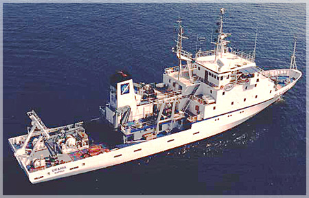
Survey ARCADIA_2010
The cruise ARCADIA (MaGIC Project) is aimed at the acquisition of multibeam ecometric data in the two map sheets of the southern Adriatic sea that are under ISMAR competence: Monopoli (map sheet 52) and Brindisi (map sheet 51). MaGIC Project is funded by the Italian Civil Protection Department for the acquisition of high-resolution morphobatimetric data along Italian continental margins. Is expected the production of “Map of the elements of geohazards of the Itralian Seas”, consisting of 72 map sheets at scale 1:50.000, of which 19 pertaining to ISMAR-CNR UOS Bologna. For each sheet there are four thematic maps. They highlight different aspects of the geohazard and the different scales at which it can be investigated and represented.
Simple
- Date (Creation)
- 2021-04-20
- Presentation form
- Digital document
- Credit
- © CNR-ISMAR
- Status
- Completed
- Maintenance and update frequency
- As needed
- Survey type
-
- Cartography
- Geology
- Geophysics
- Oceanography
- Sedimentology
- Hydrology
- Biology
- Device
-
- Sediment trap
- Chirp
- Multibeam
- CTD profiler
- Keywords
-
- oceanographic cruise
- ARCADIA
- southern Adriatic Sea
- eastern Apulia
- Map of the Elements of Geohazards of the Italian Seas
- mooring
- zooplankton
- MAGIC
- GEMET - INSPIRE themes, version 1.0
-
- Geology
- Elevation
- Continents, countries, sea regions of the world.
-
- Mediterranean Region
- Adriatic Sea
- Italy
- Use limitation
- none
- Access constraints
- Other restrictions
- Other constraints
- Data policy
Resource constraints
No information provided.
- Use constraints
- Other restrictions
- Other constraints
- Data policy
- Classification
- Unclassified
- Metadata language
- Italiano
- Topic category
-
- Geoscientific information
N
S
E
W
))
- Supplemental Information
- Southern Adriatic Sea, eastern Apulia
- Distribution format
-
-
PDF
(
(.pdf)
)
-
PDF
(
(.pdf)
)
- OnLine resource
-
Cruise report
(
WWW:DOWNLOAD-1.0-http--download
)
PDF
- OnLine resource
-
Cruise report
(
WWW:LINK-1.0-http--link
)
PDF
- Hierarchy level
- Non geographic dataset
- Other
- Report
Conformance result
- Date (Revision)
- 2021-04-20
- Explanation
- Validated in Geonetwork according to the ISO19115 rules (24/24)
- Pass
- Yes
- Statement
- Report produced by Dr. F. Foglini (ISMAR-CNR) in March 2010, as part of the oceanographic cruise ARCADIA_2010
- File identifier
- c19ddaff-02ca-4c10-a346-16407300ced1 XML
- Metadata language
- English
- Character set
- UTF8
- Hierarchy level
- Non geographic dataset
- Hierarchy level name
- Report
- Date stamp
- 2022-09-26T23:53:27
- Metadata standard name
- ISO 19115:2003/19139
- Metadata standard version
- 1.0
Overviews
Spatial extent
N
S
E
W
Provided by

Associated resources
Not available