CNR-ISMAR
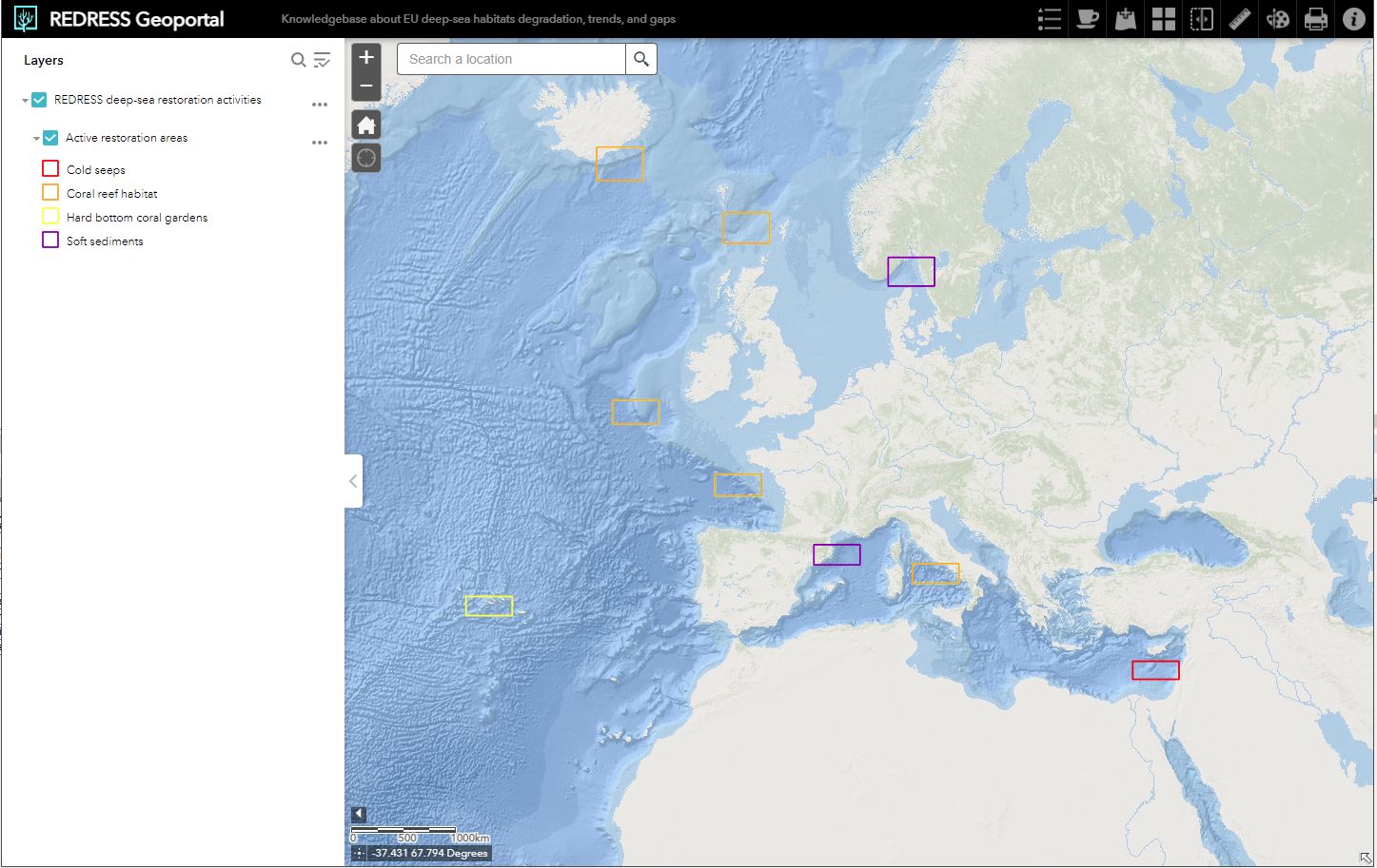
REDRESS Geoportal
The REDRESS Geoportal has been implemented in the framework of the REDRESS Project - WP1 - Task 1. The geoportal is the key sharing point where partners and the public can visualize and access the collected spatial data during the project and a synthesis of the past and current knowledge on deep-sea habitats’ degradation.
Base
- Data (Creazione)
- 2024-10-09
- Identificatore
- http://libeccio.bo.ismar.cnr.it:8080/geonetwork/srv/eng/catalog.search#/metadata/83a5b55c-0283-420d-83f1-3a66cbd6ef49
- Formato di presentazione
- Mappa digitale
- Crediti
- © REDRESS Project
- Status
- Completato
Autore
National Research Council - Institute of Marine Science (CNR-ISMAR)
-
Valentina Grande
(
Technologist
)
https://orcid.org/0000-0002-3489-268X
Via P. Gobetti 101
,
Bologna
,
40129
,
Italy
+39 051 6398872
https://orcid.org/0000-0002-3489-268X
- Frequenza di aggiornamento
- Secondo necessità
- Parole chiave
-
- webgis
- geoportal
- redress
- deep-sea ecosystems
- ecosystem restoration
- deep-sea habitats
- good and services
- governance structure
- GEMET - INSPIRE themes, version 1.0
-
- Habitats and biotopes
- Protected sites
- Area management/restriction/regulation zones and reporting units
- Limitazione d’uso
- none
- Vincoli di accesso
- Altri vincoli
- Altri vincoli
- Free access
Vincoli sulla risorsa
No information provided.
- Vincoli di fruibilità
- Altri vincoli
- Altri vincoli
- CC-BY
- Classificazione
- Non riservato
- Lingua dei metadati
- English
- Tema
-
- Informazioni geoscientifiche
- Descrizione
- Ligurian Sea, Tyrrhenian Sea, Ionaina Sea, Adriatic Sea
N
S
E
W
))
- Informazioni supplementari
- none
- Formato di distribuzione
-
-
html5 web application
(
html5
)
-
html5 web application
(
html5
)
Distributore
National Research Council - Institute of Marine Science (CNR-ISMAR)
-
Director
(
Director
)
- Risorsa online
-
REDRESS Geoportal
(
WWW:LINK-1.0-http--link
)
URL
- Livello
- Dataset non geografici
- Altro
- Web application
Conformità
- Data (Revisione)
- 2020-10-09
- Spiegazione
- Validated in Geonetwork according to the ISO19115 rules (24/24)
- Pass
- Yes
- Genealogia del dato – Processo di produzione
- Created in the framework of the NBFC using the ESRI suite (ArcGIS 10.5, ArcGIS server) and the Content Management System Moka (Semenda srl)
- Identificatore del file di metadati
- 83a5b55c-0283-420d-83f1-3a66cbd6ef49 XML
- Lingua dei metadati
- English
- Set dei caratteri dei metadati
- UTF8
- Identificatore metadati di rango superiore
- REDRESS Project - Restoration of deep-sea habitats to rebuild European Seas ddf6ded8-84d7-4cf2-bfb8-1232708a8feb
- Livello gerarchico
- Dataset non geografici
- Nome del livello gerarchico
- Web application
- Data dei metadati
- 2025-01-22T09:29:33
- Nome dello Standard dei metadati
- ISO 19115:2003/19139
- Versione dello Standard dei metadati
- 1.0
Punto di contatto
National Research Council - Institute of Marine Science (CNR-ISMAR)
-
Valentina Grande
(
Catalogue manager
)
https://orcid.org/0000-0002-3489-268X
Via P. Gobetti 101
,
Bologna
,
40129
,
Italy
+39 051 6398872
https://orcid.org/0000-0002-3489-268X