CNR-ISMAR
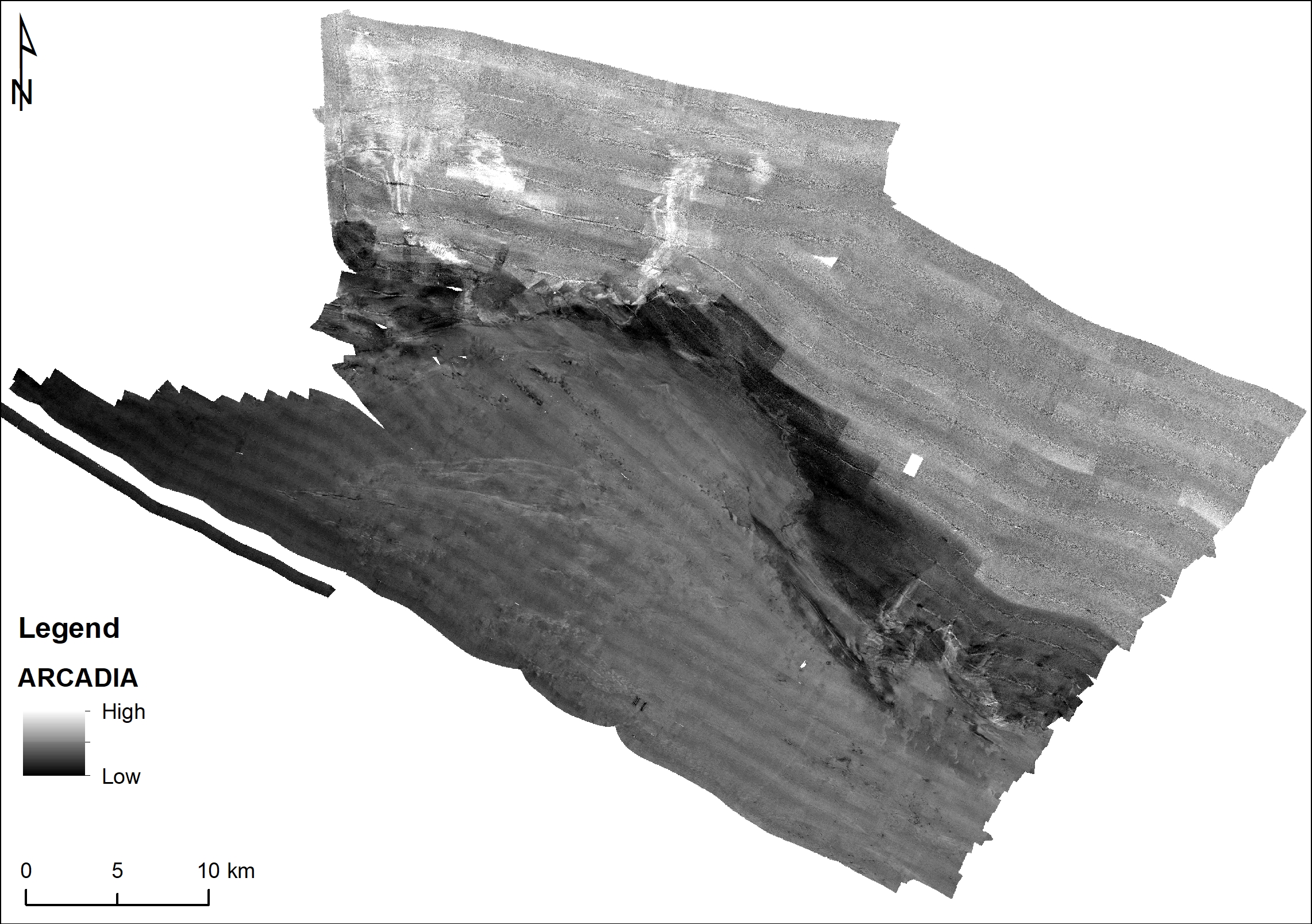
ARCADIA backscatter
The data have been acquired with SIMRAD KONGSBERG EM710 multi beam echosounder on board the R/V URANIA in good sea state. For an overall morphological generic description of the SW Adriatic margin see: F. Foglini, E. Campiani, F. Trincardi (2016). The reshaping of the South West Adriatic Margin by cascading of dense shelf waters. Marine Geology 375, 64-81.
Simple
- Date (Creation)
- 2021-04-19
- Identifier
- http://libeccio.bo.ismar.cnr.it:8080/geonetwork/srv/ita/catalog.search#/metadata/76516bee-05e1-43b1-8f28-67d2aa26f9d0 / GEONETWORK
- Unique resource identifier
- EMODnet Global CDI ID 1015915; EMODnet LOCAL:CNR-ISMAR-12
- Credit
- © CNR-ISMAR
- Status
- On going
Principal investigator
National Research Council (CNR)
-
Marco Taviani
(
Technologist
)
Bologna
,
Italy
https://orcid.org/0000-0002-2736-0052
- Maintenance and update frequency
- As needed
- GEMET - INSPIRE themes, version 1.0
-
- Elevation
- Geology
- Marine regions and subregions
-
- Adriatic Sea
- Platform Type
-
- research vessel
- Survey type
-
- Geophysics
- Cartography
- Survey
-
- ARCADIA
- Collection method
-
- Sonar system
- Device
-
- Multibeam
- Swath type
-
- Seabed reflectivity
- Use limitation
- None
- Use constraints
- License
- Other constraints
- CC-BY
- Access constraints
- Other restrictions
- Other constraints
- By negotiation
- Classification
- Restricted
- Aggregate Datasetindentifier
- 7177aab8-b851-431c-ae1a-56cf97072152
- Association Type
- Larger work citation
- Initiative Type
- Project
- Spatial representation type
- Vector
- Metadata language
- Italiano
- Character set
- UTF8
- Topic category
-
- Elevation
- Geoscientific information
Extent
- Description
- mediterranean sea; eastern basin; adriatic sea

Extent
- Begin date
- 2010-03-13
- End date
- 2010-03-24
- Supplemental Information
- none
- Reference system identifier
- EPSG:3857 - WGS84 Web Mercator (Auxiliary Sphere)
- Topology level
- Geometry only
- Geometric object type
- Surface
- Geometric object count
- 1
- Distribution format
-
-
Shapefile
(
.shp
)
-
ESRI GRID
(
.asc
)
- Specification
- NAS ISMAR Bologna
-
Shapefile
(
.shp
)
Distributor
National Research Council (CNR) - Institute of Marine Science (ISMAR)
http://www.ismar.cnr.it/
- OnLine resource
-
Web application
(
WWW:LINK-1.0-http--link
)
ISMAR Spatial Database - Web application
- OnLine resource
-
Backscatter ARCADIA
(
WWW:LINK-1.0-http--link
)
Grid
- Hierarchy level
- Dataset
- Dataset
- Seafloor reflectivity
Conformance result
- Date (Publication)
- 2020-10-09
- Explanation
- Validated in Geonetwork according to the ISO19115 rules (25/25) and the INSPIRE rules (30/30)
- Pass
- Yes
- Statement
- The data have been acquired with SIMRAD KONGSBERG EM710 multi beam echosounder on board the R/V URANIA in good sea state. For an overall morphological generic description of the SW Adriatic margin see: F. Foglini, E. Campiani, F. Trincardi (2016). The reshaping of the South West Adriatic Margin by cascading of dense shelf waters. Marine Geology 375, 64-81.
- Description
- Processed by CNR-ISMAR with the software CARIS v. xx
- File identifier
- 76516bee-05e1-43b1-8f28-67d2aa26f9d0 XML
- Metadata language
- English
- Character set
- UTF8
- Hierarchy level
- Dataset
- Date stamp
- 2022-09-28T16:13:46
- Metadata standard name
- ISO 19115:2003/19139
- Metadata standard version
- 1.0