CNR-ISMAR
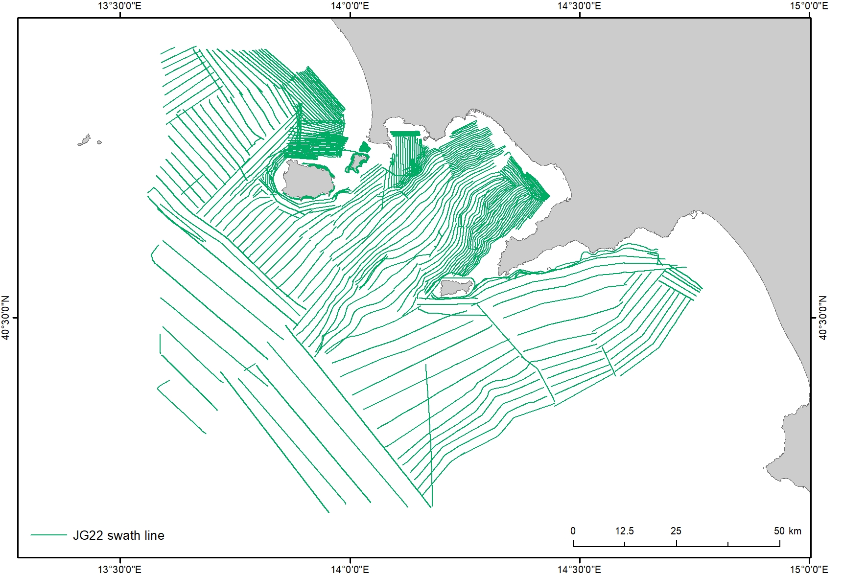
JammeGaia22 swath lines
Base
- Data (Creazione)
- 2020-10-09
- Data (Pubblicazione)
- 2024-01-15
- Identificatore
-
https://www.marine-geo.org/doi/10.60521/331589
https://www.marine-geo.org/doi/10.60521/331587
https://www.marine-geo.org/doi/10.60521/331584
- Data (Pubblicazione)
- 2024-02-28
Processor National Research Council (CNR) - Institute of Marine Science (ISMAR) - Mariacristina Prampolini ( Researcher )
via Gobetti 101 , Bologna , 40129 , Italyhttps://orcid.org/0000-0002-0408-4411- Altri dettagli
- How to site these datasets: Cite as: Foglini, F., (2024). Processed EM2040 Acoustic Backscatter and Swath Bathymetry data from R/V Gaia Blu cruise Jamme Gaia22 (2022). MGDS. doi:10.60521/331589 Foglini, F., (2024). Processed EM712 Acoustic Backscatter and Swath Bathymetry data from R/V Gaia Blu cruise Jamme Gaia22 (2022). MGDS. doi:10.60521/331587 Foglini, F., (2024). Processed EM304 Acoustic Backscatter and Swath Bathymetry data from R/V Gaia Blu cruise Jamme Gaia22 (2022). MGDS. doi:10.60521/331584
- Crediti
-
© CNR-ISMAR,
Reference: F. Foglini, M. Rovere, R. Tonielli, G. Castellan, M. Prampolini, F. Budillon, M. Cuffaro, G. Di Martino, V. Grande, S. Innangi, M.F. Loreto, L. Langone, F. Madricardo, A. Mercorella, P. Montagna, C. Palmiotto, C. Pellegrini, A. Petrizzo, L. Petracchini, A. Remia, M. Sacchi, D. Sanchez Galvez, A.N. Tassetti, F. Trincardi. A new multi-resolution bathymetric dataset of the Gulf of Naples (Italy) from complementary multi-beam echosounders. (in press)
- Status
- Completato
- Frequenza di aggiornamento
- Secondo necessità
- GEMET - INSPIRE themes, version 1.0
-
- Elevation
- Geology
- Continents, countries, sea regions of the world.
-
- Mediterranean Sea
- Tyrrhenian Sea
- Italy
- Platform Type
-
- research vessel
- Survey type
-
- Geophysics
- Cartography
- Campaign
-
- JAMMEGAIA22
- Collection method
-
- Sonar system
- Device
-
- Multibeam
- Swath type
-
- Bathymetry
- Seabed reflectivity
- Limitazione d’uso
- None
- Vincoli di fruibilità
- Licenza
- Altri vincoli
- CC BY 4.0
- Vincoli di accesso
- Licenza
- Altri vincoli
- CC BY 4.0
- Classificazione
- Non riservato
- Tipo di rappresentazione spaziale
- Dati vettoriali
- Lingua dei metadati
- English
- Set dei caratteri dei metadati
- UTF8
- Tema
-
- Biologia
Estensione

- Data di inizio
- 2022-09-28
- Data di fine
- 2022-10-28
- Informazioni supplementari
- none
- Identificatore del sistema di riferimento
- EPSG / 32633 - WGS 84 / UTM zone 33N
informazioni sulla rappresentazione spaziale
- Livello di topologia
- Solo Geometria
- Oggetto di tipo geometrico
- Curva
- Conteggio oggetto geometrico
- 775
- Formato di distribuzione
-
-
Shapefile
(
.shp
)
-
Generic sensor format (GSF)
(
.gsf
)
-
Shapefile
(
.shp
)
- Risorsa online
-
Web application
(
WWW:LINK-1.0-http--link
)
ISMAR Spatial Database - Web application
- Risorsa online
-
Swath lines
(
WWW:LINK-1.0-http--link
)
GSF files
- Livello
- Dataset
- Dataset
- Dataset
Conformità
- Data (Pubblicazione)
- 2020-10-09
- Spiegazione
- Validated in Geonetwork according to the ISO19115 rules (25/25) and the INSPIRE rules (30/30)
- Pass
- Yes
- Genealogia del dato – Processo di produzione
- The processing of the raw data was carried out using the QPS Qimera v.2.5.0 software (Quality Positioning Services BV, Zeist, Netherlands) following a standard procedure, which includes sound speed correction, removal of erroneous soundings, and correction of vertical offsets. The quality of the data was initially checked using the ‘Cross Check Tool’ to check for soundings with significant offsets from the local mean water depth. The processed bathymetric data were exported into GSF format for backscatter processing. The MBES backscatter data were processed using the QPS Fledermaus Geocoder Tool (FMGT) v.7.10.2 software. The processed MBES data (.gsf) were used to apply backscatter corrections, beam pattern correction, and angle-varying gain (AVG) corrections to the backscatter data. After these corrections, FMGT applied the sonar’s navigation data to improve the spatial accuracy of the data.
- Identificatore del file di metadati
- 6213658d-ca9a-4e40-af07-e4f7b329203a XML
- Lingua dei metadati
- English
- Set dei caratteri dei metadati
- UTF8
- Identificatore metadati di rango superiore
- Survey JAMMEGAIA22 6cd1080c-f41f-4c9d-907b-297d25f554e5
- Livello gerarchico
- Dataset
- Data dei metadati
- 2024-06-04T13:08:23
- Nome dello Standard dei metadati
- ISO 19115:2003/19139
- Versione dello Standard dei metadati
- 1.0