CNR-ISMAR
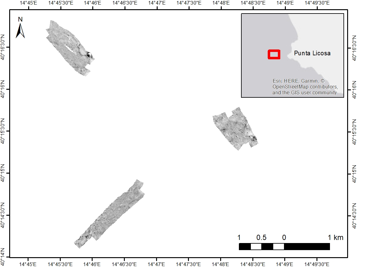
Side Scan Sonar CORSUB0624
Side Scan Sonar surface acquired in the framework of the CORSUB0624 oceanographic campaing (CORSUB Project)
Base
- Data (Creazione)
- 2024
- Data (Pubblicazione)
- 2024
- Identificatore
-
http://libeccio.bo.ismar.cnr.it:8080/geonetwork/srv/eng/catalog.search#/metadata/349fdb1e-d358-4a2f-b949-09423e25989e
- Data (Pubblicazione)
- 2024-11-18
- Crediti
- © CORSUB -To the CORe of the SUBstrate: inception and development of Mediterranean algal reefs - PRIN project N° 2022RKHBMB
- Status
- In corso
Processor
National Research Council (CNR) - Institute of Marine Science (ISMAR)
-
Sara Innangi
(
Researcher
)
Calata Porta Di Massa Porto Di Napoli, 80
,
Naples
,
80133
,
Italy
https://orcid.org/0000-0002-7692-9356
Fornitore della risorsa
National Research Council (CNR) - Institute of Marine Science (ISMAR)
-
Renato Tonielli
(
Technologist
)
Calata Porta Di Massa Porto Di Napoli, 80
,
Naples
,
80133
,
Italy
- Frequenza di aggiornamento
- Secondo necessità
- GEMET - INSPIRE themes, version 1.0
-
- Geology
- Continents, countries, sea regions of the world.
-
- Italy
- Mediterranean Sea
- Tyrrhenian Sea
- Platform Type
-
- research vessel
- Survey type
-
- Geophysics
- Habitat mapping
- Campaign
-
- CORSUB0624
- Collection method
-
- Sonar system
- Device
-
- Side Scan Sonar
- Swath type
-
- Seabed reflectivity
- Parole chiave
-
- punta licosa
- sss
- side scan sonar
- corsub
- Limitazione d’uso
- Do not use for navigation
- Vincoli di fruibilità
- Altri vincoli
- Altri vincoli
- Data policy of the project: https://corsub.disat.unimib.it/project/data-policy
- Vincoli di accesso
- Altri vincoli
- Altri vincoli
- Data policy of the project: https://corsub.disat.unimib.it/project/data-policy
- Classificazione
- Non riservato
- Tipo di rappresentazione spaziale
- Dati raster
- Lingua dei metadati
- English
- Set dei caratteri dei metadati
- UTF8
- Tema
-
- Informazioni geoscientifiche
Estensione

Estensione
- Data di inizio
- 2024-06-23
- Data di fine
- 2024-06-28
- Informazioni supplementari
- none
- Identificatore del sistema di riferimento
- EPSG:32633 - WGS 84 / UTM zone 33N
- Livello di topologia
- Solo Geometria
- Oggetto di tipo geometrico
- Superficie
- Conteggio oggetto geometrico
- 3
- Formato di distribuzione
-
-
GeoTIFF
(
.tif
)
-
GeoTIFF
(
.tif
)
- Livello
- Modello
- Dataset
- Seafloor reflectivity
Conformità
- Data (Pubblicazione)
- 2023-07-01
- Spiegazione
- Validated in Geonetwork according to the ISO19115 rules (25/25) and the INSPIRE rules (30/30)
- Pass
- Yes
- Genealogia del dato – Processo di produzione
- Geophysical data collected by the Institute of Marine Sciences (ISMAR) of the National Research Council (CNR) in collaboration with Università degli Studi di Milano-Bicocca (UNIMIB) in the framework of the CORSUB Project during the CORSUB0624 oceanographic campaign. Data have been collected using the SSS xxx and processed using xxx.
- Identificatore del file di metadati
- 349fdb1e-d358-4a2f-b949-09423e25989e XML
- Lingua dei metadati
- English
- Set dei caratteri dei metadati
- UTF8
- Identificatore metadati di rango superiore
- Survey CORSUB0624 bb6ff636-4b1a-4086-8545-6b3f6203ae34
- Livello gerarchico
- Modello
- Nome del livello gerarchico
- Seafloor reflectivity
- Data dei metadati
- 2025-03-26T12:41:18
- Nome dello Standard dei metadati
- ISO 19115:2003/19139
- Versione dello Standard dei metadati
- 1.0