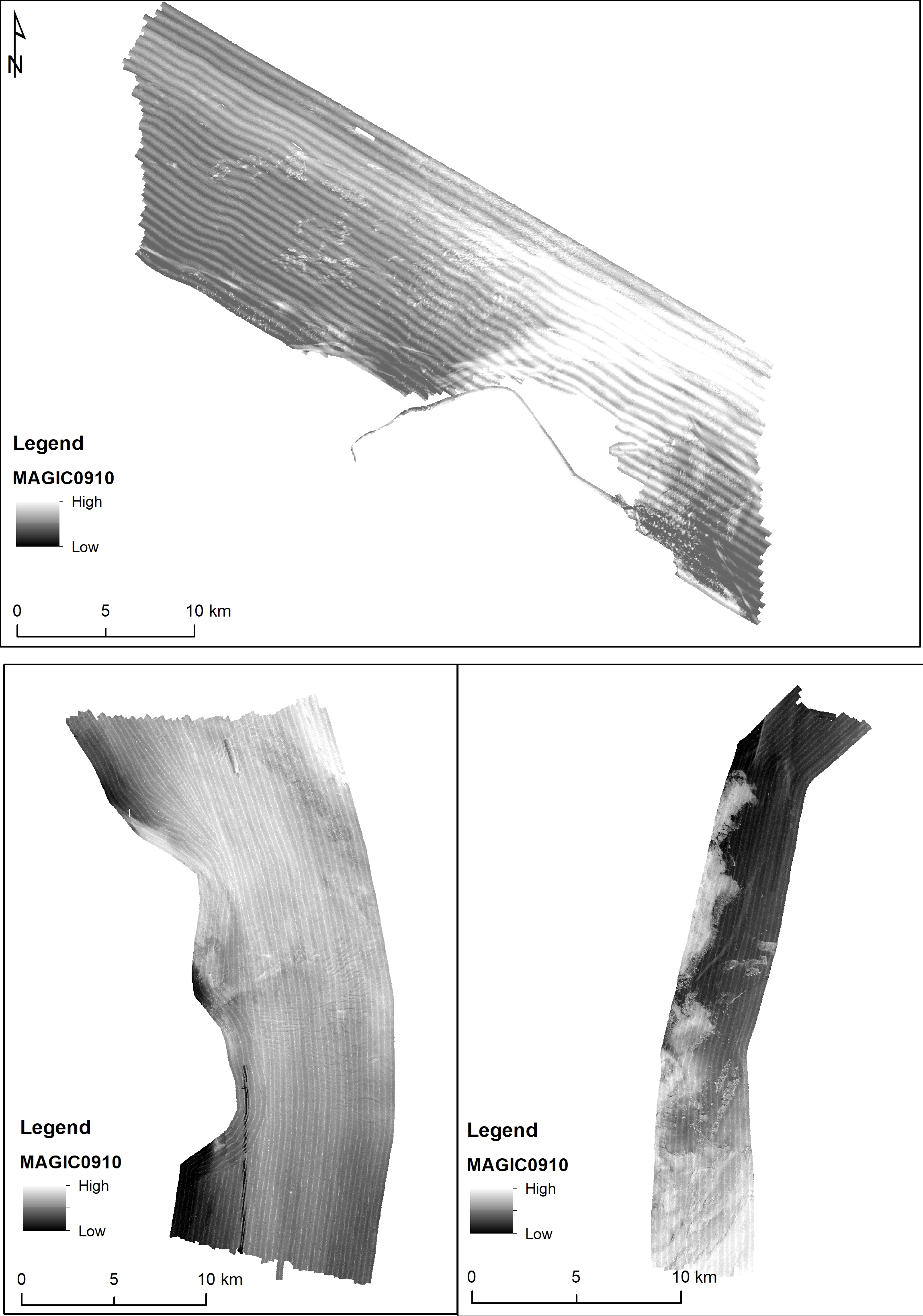
Backscatter MAGIC0910
nessuno
Base
- Data (Creazione)
- 2021-04-19
- Identificatore
- http://libeccio.bo.ismar.cnr.it:8080/geonetwork/srv/ita/catalog.search#/metadata/31aea371-7e29-42c2-883a-ab580fd0d3d9 / GEONETWORK
- Identificatore unico di risorsa
- EMODnet Global CDI ID: 1259013; EMODnet Local CDI ID: 145_CNR-ISMAR-47
- Crediti
- © CNR-ISMAR
- Status
- In corso
Ricercatore principale
Consiglio Nazionale delle Ricerche (CNR)
-
Federica Foglini
(
Tecnologo
)
Bologna
,
Italia
https://orcid.org/0000-0002-2736-0052
- Frequenza di aggiornamento
- Secondo necessità
- GEMET - INSPIRE themes, version 1.0
-
- Elevazione
- Geologia
- Marine regions and subregions
-
- Mar Adriatico
- Platform Type
-
- research vessel
- Survey type
-
- Geofisica
- Cartografia
- Survey
-
- MAGIC_09_10
- Collection method
-
- Sonar
- Device
-
- Multibeam
- Swath type
-
- Riflettività del fondale
- Limitazione d’uso
- Nessuna condizione applicabile
- Vincoli di fruibilità
- Licenza
- Altri vincoli
- CC-BY
- Vincoli di accesso
- Altri vincoli
- Altri vincoli
- Tramite negoziazione
- Classificazione
- Riservato
- Tipo di rappresentazione spaziale
- Dati vettoriali
- Lingua dei metadati
- Italiano
- Set dei caratteri dei metadati
- UTF8
- Tema
-
- Quote e prodotti derivati
- Informazioni geoscientifiche
Estensione
- Descrizione
- mar mediterraneo; bacino est; mar adriatico

Estensione
- Data di inizio
- 2010-09-09
- Data di fine
- 2010-09-24
- Informazioni supplementari
- nessuna
- Identificatore del sistema di riferimento
- EPSG:3857 - WGS84 Web Mercator (Auxiliary Sphere)
- Livello di topologia
- Solo Geometria
- Oggetto di tipo geometrico
- Superficie
- Conteggio oggetto geometrico
- 3
- Formato di distribuzione
-
-
Shapefile
(
.shp
)
-
ESRI grid
(
.asc
)
- Specifiche
- NAS ISMAR Bologna
-
Shapefile
(
.shp
)
Distributore
Consiglio Nazionale delle Ricerche (CNR) - Istituto di Scienze Marine (ISMAR)
http://www.ismar.cnr.it/
- Risorsa online
-
Applicazione web
(
WWW:LINK-1.0-http--link
)
Applicazione web per dati spaziali ISMAR
- Risorsa online
-
Backscatter MAGIC0910
(
WWW:LINK-1.0-http--link
)
Ascii e Grid
- Livello
- Dataset
- Dataset
- Seafoor reflectivity
Conformità
- Data (Pubblicazione)
- 2020-10-09
- Spiegazione
- Validato in Geonetwork sulla base delle regole ISO19115 rules (26/26) e INSPIRE (30/30)
- Pass
- Yes
- Genealogia del dato – Processo di produzione
- The bathymetric data have been acquired with a Kongsberg EM3002 dual head multi beam echosounder hull-mounted on board the CNR M/P Maria Grazia, in the Framework of MAGIC (Marine Geohazards Along the Italian Coasts project), an integrated research project funded by the Italian Civil Protection Department for acquiring high-resolution morphobathymetry and producing geohazard maps of the continental margins of Italy. Sea state was not always good during the acquisition.
- Descrizione
- Processato dal CNR-ISMAR tramite il software CARIS v. xx
- Identificatore del file di metadati
- 31aea371-7e29-42c2-883a-ab580fd0d3d9 XML
- Lingua dei metadati
- English
- Set dei caratteri dei metadati
- UTF8
- Identificatore metadati di rango superiore
- Survey MAGIC ISMAR 09/10 886689dc-a0f9-44f1-9e40-5b6fff98259c
- Livello gerarchico
- Dataset
- Data dei metadati
- 2022-09-28T16:08:51
- Nome dello Standard dei metadati
- ISO 19115:2003/19139
- Versione dello Standard dei metadati
- 1.0
 CNR-ISMAR

