 CNR-ISMAR
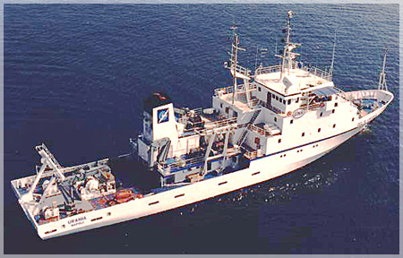
Survey MAGIC ISMAR 04/09
During the cruise MAGIC ISMAR 07/09 is expected the conclusion of sheets Monopoli (map sheet 52) and Bari (map sheet 53). Furthermore, the acquisition of part of sheet Brindisi (map sheet 51) is expected, as regards eastern Apulia. As regards southern Tyrrhenian sea, the acquisition of the bathymetric data relative to the specifications of the instrument supplied for the sheets Milazzo (map sheet 17) and Alicudi (map sheet 19) is planned. The thematic maps that will be created will constitute a cognitive tool that the Civil Protection Department will have at its disposal for the management of territorial risks, but also a basis for research activities in marine areas that are geologically and largely still little known. MaGIC Project is funded by the Italian Civil Protection Department for the acquisition of high-resolution morphobatimetric data along Italian continental margins. Is expected the production of “Map of the elements of geohazards of the Itralian Seas”, consisting of 72 map sheets at scale 1:50.000, of which 19 pertaining to ISMAR-CNR UOS Bologna. For each sheet there are four thematic maps. They highlight different aspects of the geohazard and the different scales at which it can be investigated and represented.
Simple
- Date (Creation)
- 2021-05-12
- Presentation form
- Digital document
- Credit
- © CNR-ISMAR
- Status
- Completed
- Maintenance and update frequency
- As needed
- Survey
-
- MAGIC ISMAR 04/09
- Survey type
-
- Geology
- Seismic
- Cartography
- Geophysics
- Sedimentology
- Device
-
- Multibeam
- Chirp
- CTD profiler
- Keywords
-
- oceanographic cruise
- MAGIC
- southern Adriatic Sea
- southern Tyrrhenian Sea
- eastern Apulia
- north-eastern Sicily
- Map of the Elements of Geohazards of the Italian Seas
- GEMET - INSPIRE themes, version 1.0
-
- Geology
- Elevation
- Use limitation
- none
- Access constraints
- Other restrictions
- Other constraints
- Data policy
Resource constraints
No information provided.
- Use constraints
- Other restrictions
- Other constraints
- Data policy
- Classification
- Unclassified
- Metadata language
- Italiano
- Topic category
-
- Geoscientific information
N
S
E
W
))
- Supplemental Information
- Southern Adriatic Sea, eastern Apulia, southern Tyrrhenian Sea, north-eastern Sicily
- Distribution format
-
-
PDF
(
(.pdf)
)
-
PDF
(
(.pdf)
)
- Hierarchy level
- Non geographic dataset
- Other
- Report
Conformance result
- Date (Revision)
- 2021-02-04
- Explanation
- Validated in Geonetwork according to the ISO19115 rules (24/24)
- Pass
- Yes
- Statement
- Report produced by Dr. F. Foglini (ISMAR-CNR) and Dr. A. Remia (ISMAR-CNR) in August 2009, as part of the oceanographic cruise MAGIC ISMAR 07/09
- File identifier
- 19bd42a2-6630-4f52-b584-d7432a0e60ef XML
- Metadata language
- English
- Character set
- UTF8
- Hierarchy level
- Non geographic dataset
- Hierarchy level name
- Report
- Date stamp
- 2022-07-25T17:09:35
- Metadata standard name
- ISO 19115:2003/19139
- Metadata standard version
- 1.0
Overviews

Spatial extent
N
S
E
W
Provided by

Associated resources
Not available