CNR-ISMAR
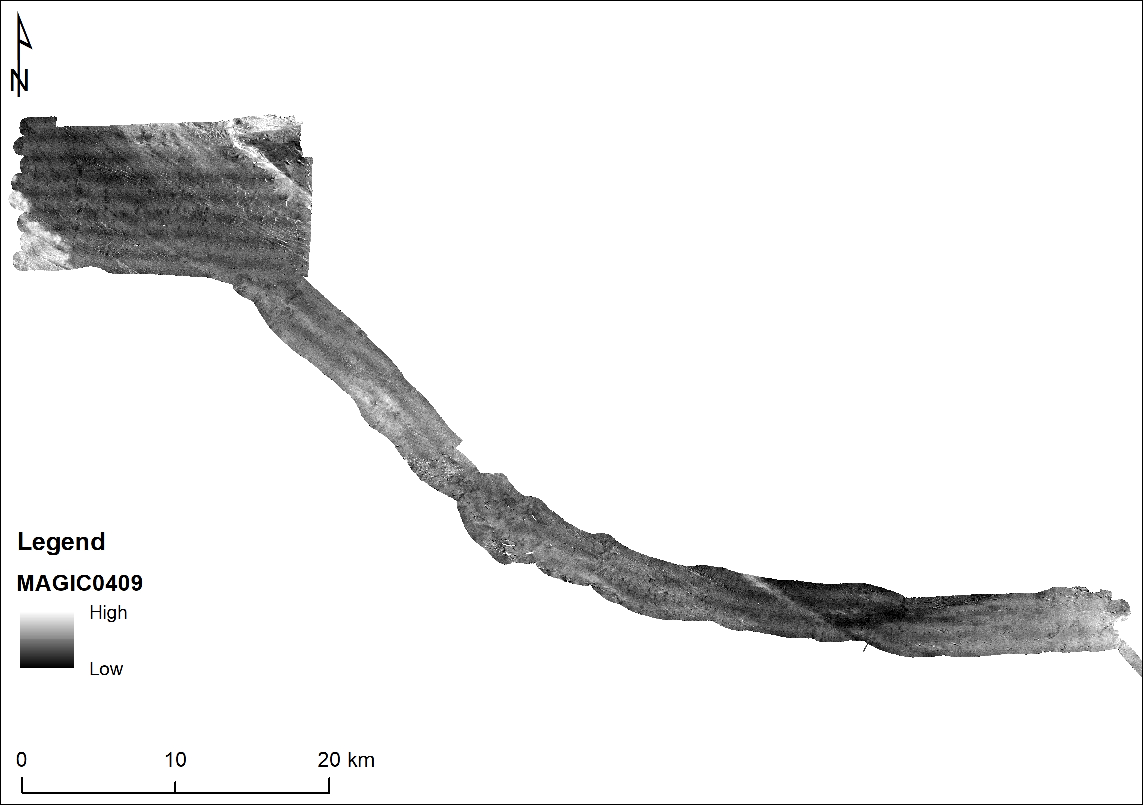
MAGIC0409 backscatter
The data have been acquired with a Kongsberg EM710 multibeam system hull-mounted on board the Italian CNR R/V Urania, in good sea state, within the framework of the MaGIC project (www.magicproject.it) for geohazard assessment along the Italian coasts. Data are mostly unpublished.
Simple
- Date (Creation)
- 2021-04-19
- Identifier
- http://libeccio.bo.ismar.cnr.it:8080/geonetwork/srv/ita/catalog.search#/metadata/0571ed5c-eb2b-471f-b974-69b788a1aecc / GEONETWORK
- Unique resource identifier
- EMODnet Global CDI ID: 1974536; EMODnet Local CDI ID: 145_CNR-ISMAR-68
- Credit
- © CNR-ISMAR
- Status
- On going
Principal investigator
National Research Council (CNR)
-
Marzia Rovere
(
Researcher
)
Bologna
,
Italy
https://orcid.org/0000-0002-1397-7086
- Maintenance and update frequency
- As needed
- GEMET - INSPIRE themes, version 1.0
-
- Elevation
- Geology
- Platform Type
-
- research vessel
- Survey type
-
- Geophysics
- Cartography
- Survey
-
- MAGIC_04_09
- Collection method
-
- Sonar system
- Device
-
- Multibeam
- Swath type
-
- Seabed reflectivity
- Use limitation
- None
- Use constraints
- License
- Other constraints
- CC-BY
- Access constraints
- Other restrictions
- Other constraints
- By negotiation
- Classification
- Restricted
- Aggregate Datasetindentifier
- 31cbb959-c331-49f0-b086-0c64aa707dee
- Association Type
- Larger work citation
- Initiative Type
- Project
- Spatial representation type
- Vector
- Metadata language
- Italiano
- Character set
- UTF8
- Topic category
-
- Elevation
- Geoscientific information
Extent
- Description
- mediterranean sea; eastern basin; adriatic sea

Extent
- Begin date
- 2009-04-04
- End date
- 2009-04-17
- Supplemental Information
- none
- Reference system identifier
- EPSG:3857 - WGS84 Web Mercator (Auxiliary Sphere)
- Topology level
- Geometry only
- Geometric object type
- Surface
- Geometric object count
- 1
- Distribution format
-
-
Shapefile
(
.shp
)
-
ESRI GRID
(
.asc
)
- Specification
- NAS ISMAR Bologna
-
Shapefile
(
.shp
)
Distributor
National Research Council (CNR) - Institute of Marine Science (ISMAR)
http://www.ismar.cnr.it/
- OnLine resource
-
Backscatter MAGIC0409
(
WWW:LINK-1.0-http--link
)
Ascii and Grid
- Hierarchy level
- Dataset
- Dataset
- Seafloor reflectivity
Conformance result
- Date (Publication)
- 2020-10-09
- Explanation
- Validated in Geonetwork according to the ISO19115 rules (25/25) and the INSPIRE rules (30/30)
- Pass
- Yes
- Statement
- The data have been acquired with a Kongsberg EM710 multibeam system hull-mounted on board the Italian CNR R/V Urania, in good sea state, within the framework of the MaGIC project (www.magicproject.it) for geohazard assessment along the Italian coasts. Data are mostly unpublished.
- Description
- Processed by CNR-ISMAR with the software CARIS v. xx
- File identifier
- 0571ed5c-eb2b-471f-b974-69b788a1aecc XML
- Metadata language
- English
- Character set
- UTF8
- Hierarchy level
- Model
- Date stamp
- 2024-10-21T10:32:09
- Metadata standard name
- ISO 19115:2003/19139
- Metadata standard version
- 1.0