 CNR-ISMAR
Type of resources
Available actions
Topics
INSPIRE themes
Provided by
Years
Formats
Representation types
Update frequencies
status
-

CORSUB project aims at the study of the inception and development of anomalous morphologies of unknown origin, found between 80 and 130 m of water depth offshore the Punta Licosa Promontory (Tyrrhenian Sea, Campania, Italy), in correspondence of deep submarine terraces ascribed to Late Upper Pleistocene. Here, groups of metrical sub-circular structures of unknown origin (and with no similar record in the literature) were identified during a survey in 2003 and never successively investigated. They are possibly related to the presence of bioconstructions, because grab samples contained living crustose coralline algae, even though they never clarified the occurrence of true biogenic framework, nor the reason for such unique shapes. These findings lead to the suspicion that deep bioconstruction, possibly coralligenous, occurs, designed by past Quaternary underwater topography of unknown origin. Mesophotic reefs of the Mediterranean Sea are few explored, especially in the deeper part of the circalittoral zone. Among them, coralligenous is the most important one, but still far from being deeply investigated. It represents an important element of the seascape, hosting a valuable biodiversity and representing a natural heritage of unknown worth. Coralligenous has been originally defined as a bioconstruction mostly made by crustose coralline algae, able to develop monumental build-ups during the geological time, not for nothing with an important fossil legacy. The geometry together with the nature of the substrate, and their possible combinations, are key factors in distinguishing different coralligenous, although the actual schemes possibly do not include all the heterogeneity of this kind of habitat, still poorly explored. Therefore, the study area represents a worthy opportunity where to explore the nature of a deep possibly coralligenous, integrating geophysical, stratigraphical, sedimentological and paleontological techniques to reconstruct the inception of this kind of framework and its development through time, under different possible phases of climate and environment during the Quaternary. CORSUB plan foresees field campaigns for the habitat mapping purpose, namely the collection of new remote (backscatter and stratigraphy) and direct (both hard substrate and mobile sediment) data. The results will be then framed in the Quaternary geological history of the area to reach the goal of this project. The occurrence of deep coralligenous is extremely important because it is considered a biodiversity hotspot, monitored and protected under several European directives. Moreover it represents a valuable natural heritage for the local stakeholders. At the same time, being the coralligenous an underexplored geological archive, the application of a multi-scale approach can contribute to the reconstruction of the dynamic of this type of biocostructions, improving the interpretation of the fossil record.
-
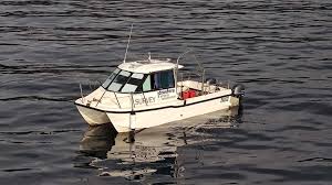
First oceanographic campaign of the CORSUB Project curried out on board of Idrosfera srl from the 23th to the 28th of June 2024 in front of Punta Licosa, Tyrrhenian Sea (Campania Region).
-
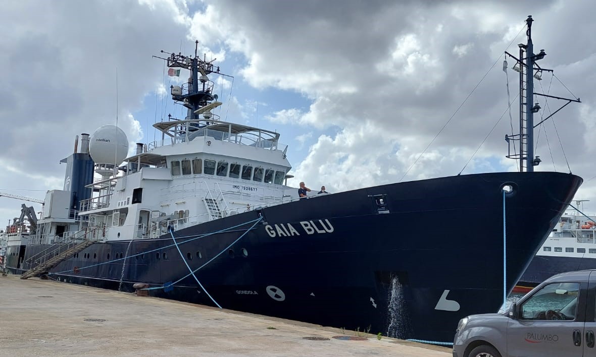
Second oceanographic campaign of the CORSUB Project curried out on board of GAIA BLU R/V from the 9th to the 20th of December 2024 in front of Punta Licosa, Tyrrhenian Sea (Campania Region).
-
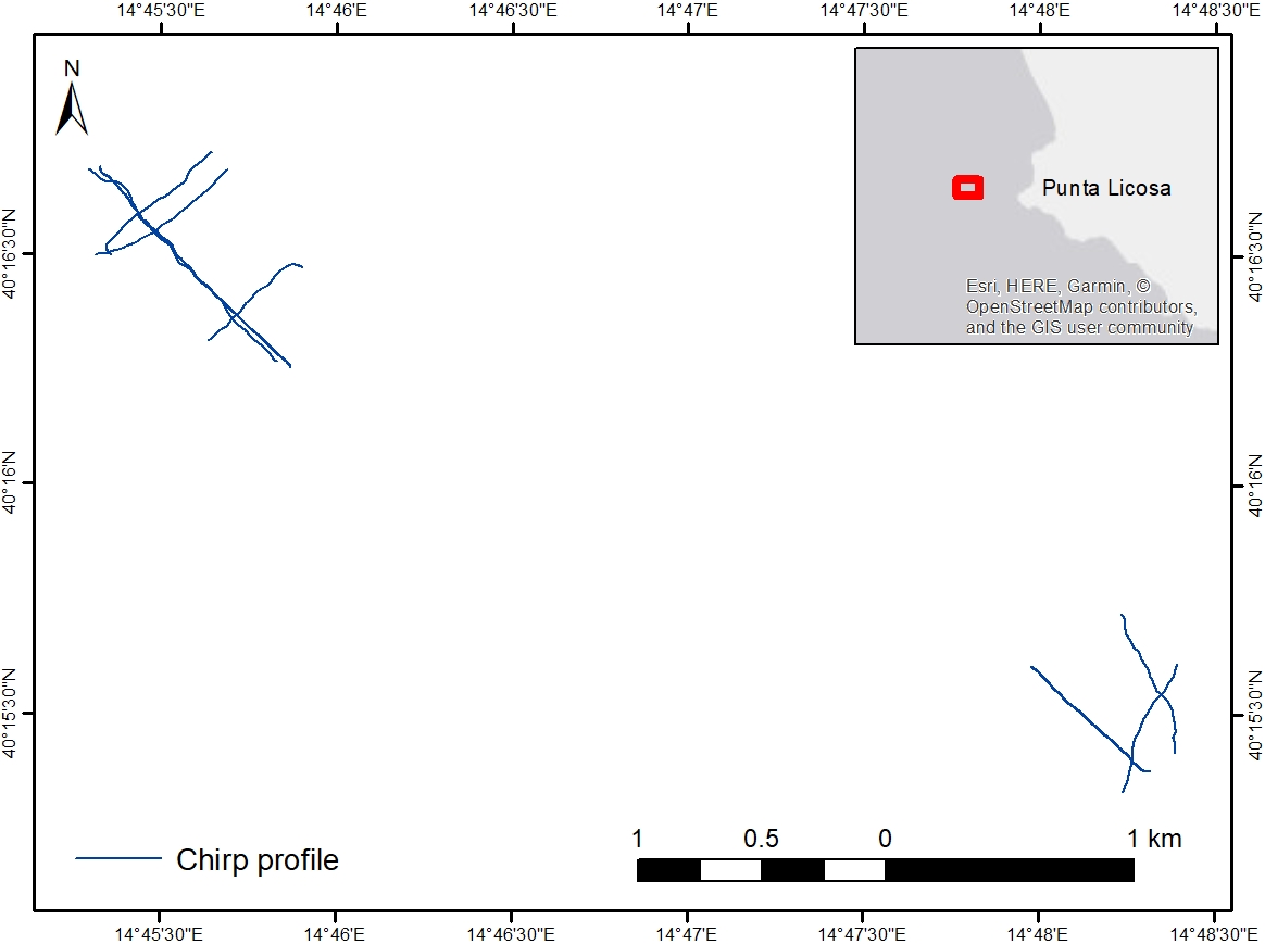
Chirp profiles acquired in the framework of the CORSUB Project during the CORSUB0624 oceanographic campaign.
-
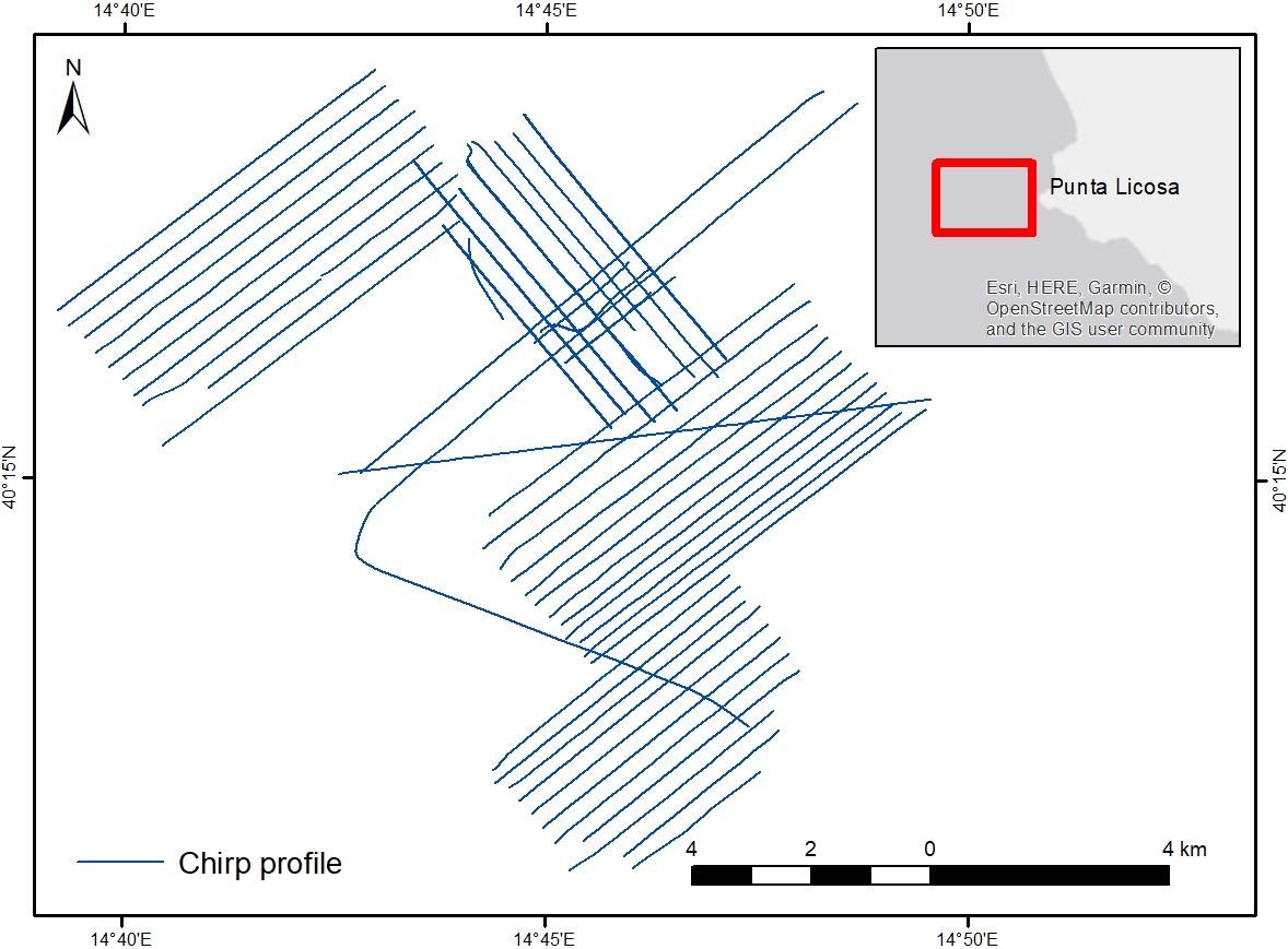
Chirp profiles acquired in the framework of the CORSUB Project during the TREMOR24 oceanographic campaign
-
Digital Elevation Model (DEM) at 102x102 meters cell resolution showing the topography and the water depth of the CORSUB study area.
-
Type of substrate characterizing the seabed (i.e. rock, sand, pelite).
-
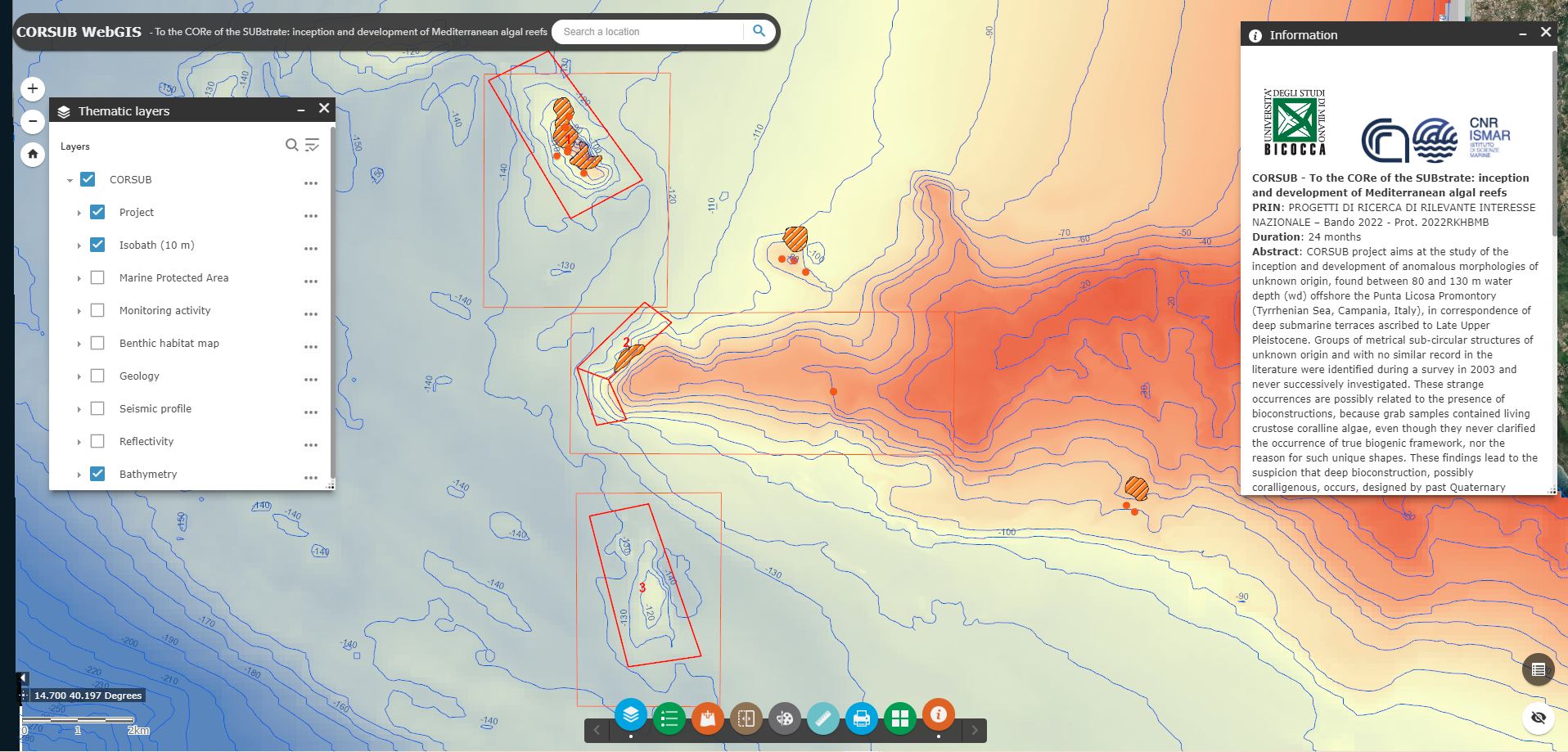
Geoportal implemented in the framework of the CORSUB Project to manage multidisciplinary spatial data at Project Area scale
-
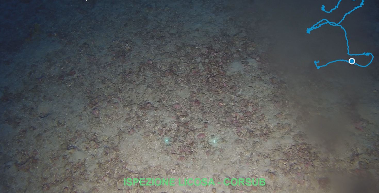
High resolution video on rhodoliths bed offshore Punta Licosa, Campania Region (Italy)
-
Geomorphologic features (ie, fault, margin, terrace) that has been created by natural Earth processes or by human activity.