 CNR-ISMAR
shapefile
Type of resources
Available actions
Topics
INSPIRE themes
Provided by
Years
Formats
Representation types
Update frequencies
status
-
Video footage of the seabed recorded by drop-frame in the Treporti Channel (1.6 km2), the Burano Channel (1.56 km2), the San Felice Channel (0.82 km2) and minor channels namely Scanello, San Antonio, Gaggian, and Riga channels, covering a total area of 4.45 km2. The surveyed channels are in the northern part of the Lagoon.
-

Il dataset descrive la distribuzione degli habitat marini d'interesse comunitario (sensu Direttiva 92/43/CEE) all'interno delle Zone Speciali di Conservazione (ZSC) lungo le coste del Lazio La pubblicazione di riferimento è Ardizzone G., Belluscio A e Criscoli A., 2018. Atlante degli habitat dei fondali marini del Lazio. Sapienza Università Editrice.
-
L'atlante fornisce una base conoscitiva naturalistica dei fondali marino-costieri, dei loro principali popolamenti, fra i quali le praterie di Posidonia oceanica ed il Coralligeno. Il rilevamento dei dati cartografati tramite interpretazione di repertorio aerofotogrammetrico, di mappatura acustica con tecnica side scan sonar e di morfobatimetrica di dettaglio con tecnica multibeam, è integrato da materiale bibliografico scientifico di settore e dalle banche dati di Regione e Arpal. Il riferimento cartografico a terra è la CTR 1:10000. Il livello è un aggiornamento della mappatura allegata alla pubblicazione Atlante degli Habitat Marini della Liguria (Diviacco/Coppo-2006), così come approvato con D.G.R.n.141 del 28/02/2020.
-
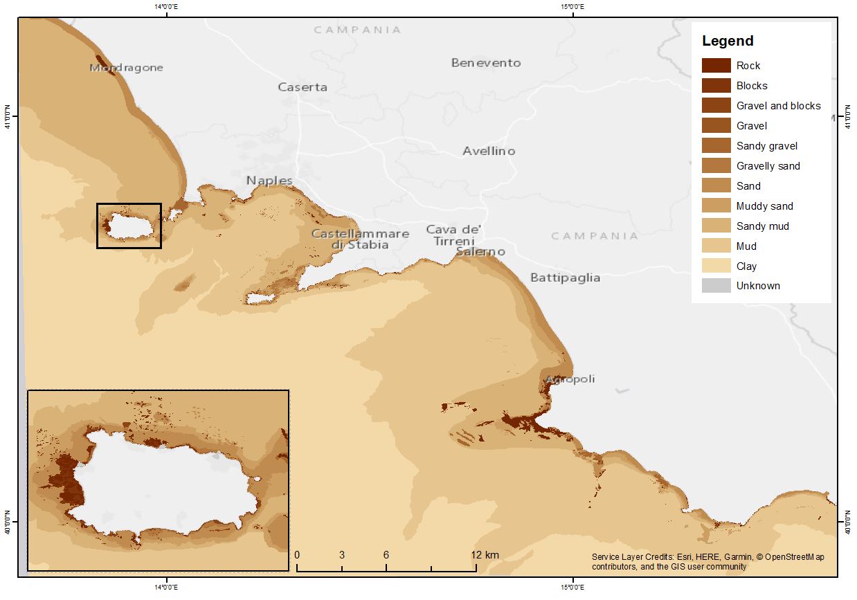
The shapefile contains the marine substrates of the Campania Region (inside 24 NM) produced in the framework of the FEAMP-ISSPA Project by CNR-ISMAR starting from the CARG cartography and the EUSeaMap from EMONnet.
-
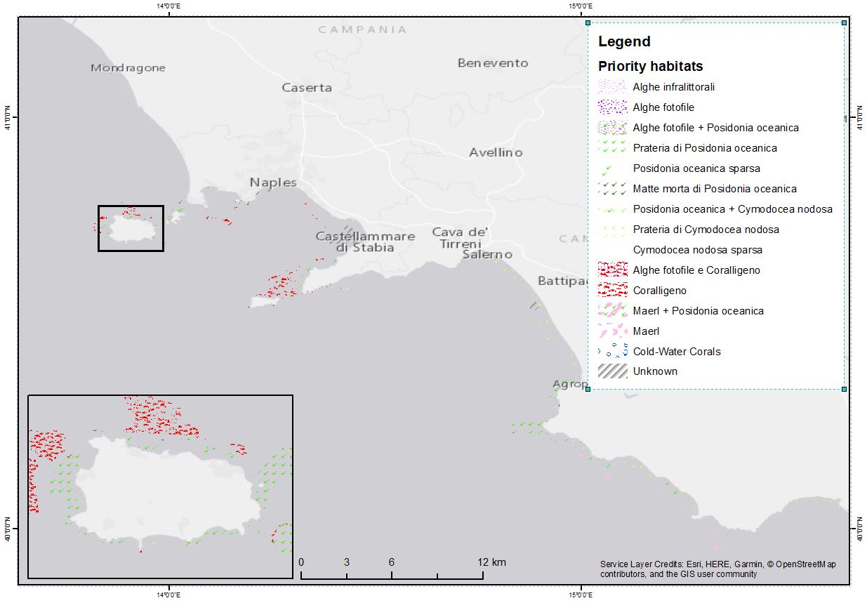
The shapefile contains the priority habitats of the Campania Region (inside 24 NM) produced in the framework of the FEAMP-ISSPA Project by CNR-ISMAR. It is the results of a bibliographic review coupled with new data (FEAMP-ISSPA) and recovered geophysics data collected by CNR-ISMAR through the years. The shapefile includes coralligenous, maerl, Posidonia oceanica, Cymodocea nodosa, photophilic algae, bioconstructions, and cold-water corals.
-
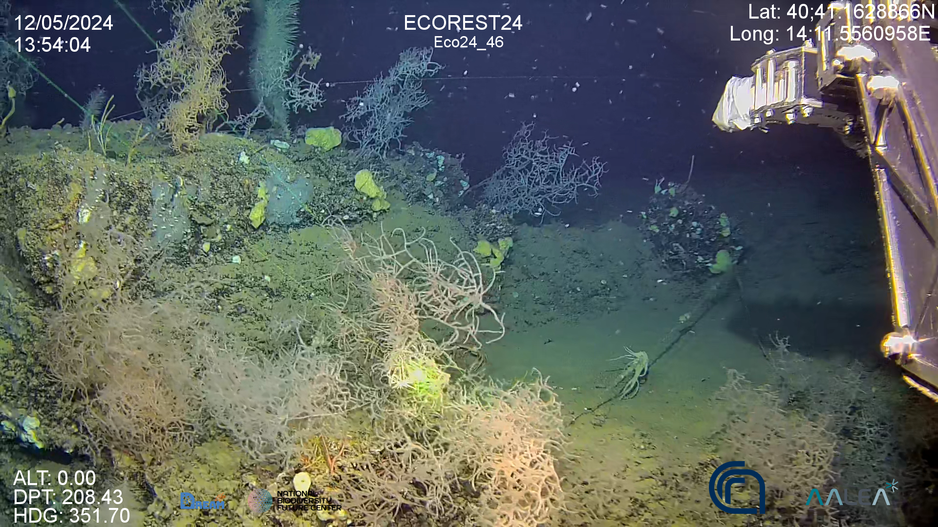
High resolution video on back corals forest in the Gulf of Naples (Italy)
-
to be filled..
-
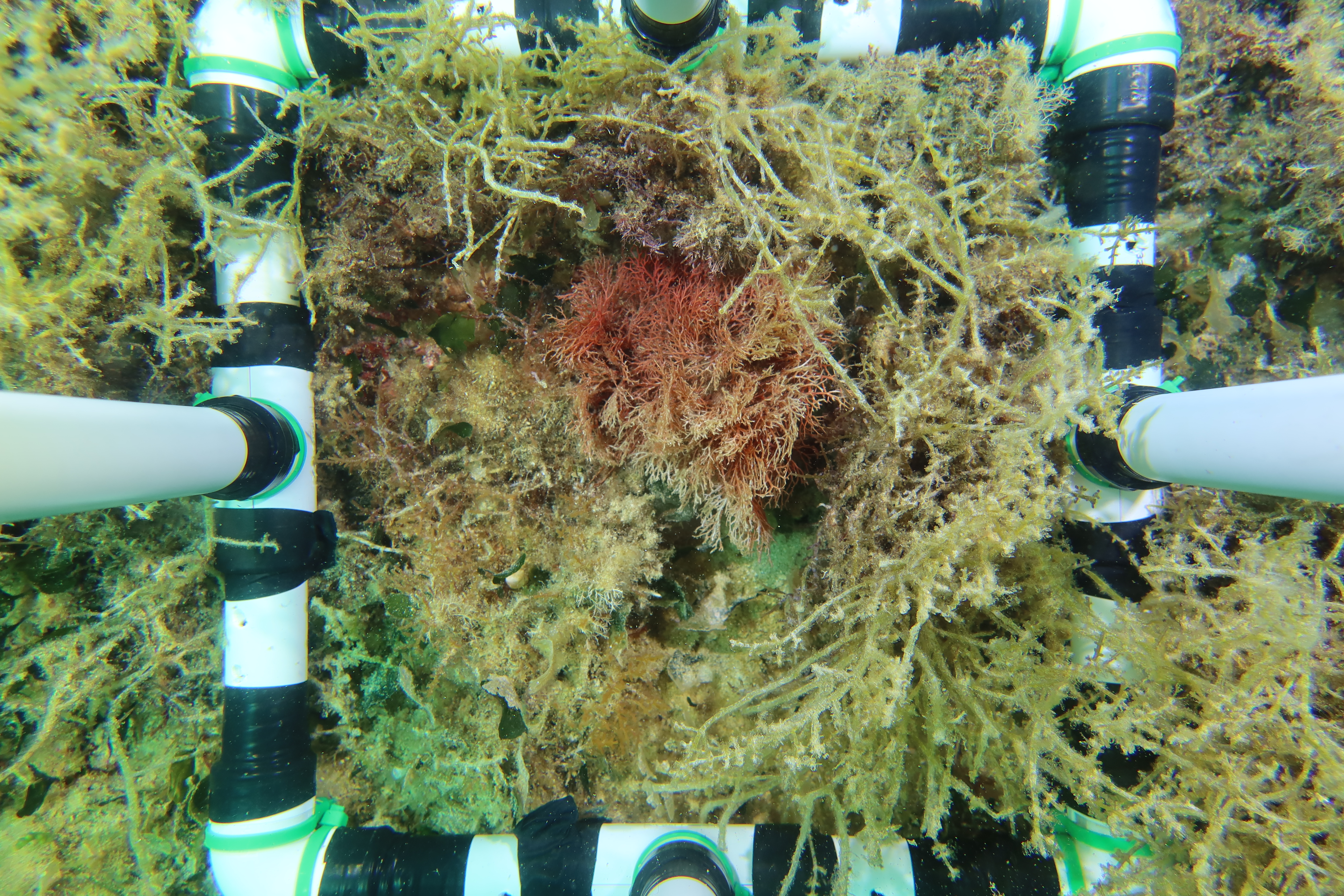
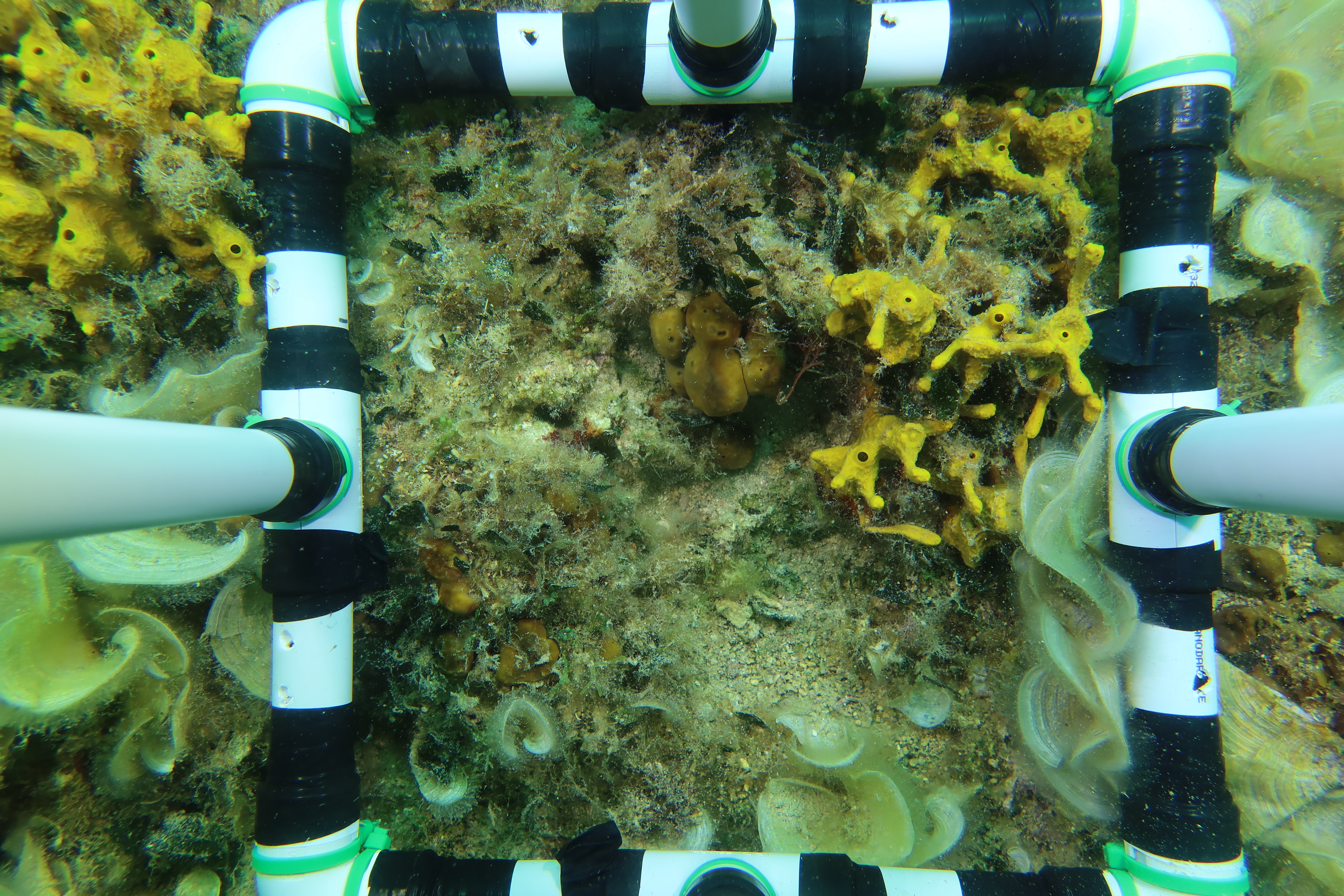
Images taken with underwater camera from MPA Regno di Nettuno and MPA Banco di Santa Croce. Correlative experiment on Coralligenous reefs in the western Mediterranean in partnership with UNISS and UNIPA: Comparison of benthic community associated with Paramuricea clavata forests before and after water stratification period. Period: May-September 2023
-
Assessment of the role of L. lithophaga on the resilience of benthic assemblages in the MPA of Porto Cesareo in the period May 2023-July 2024
-
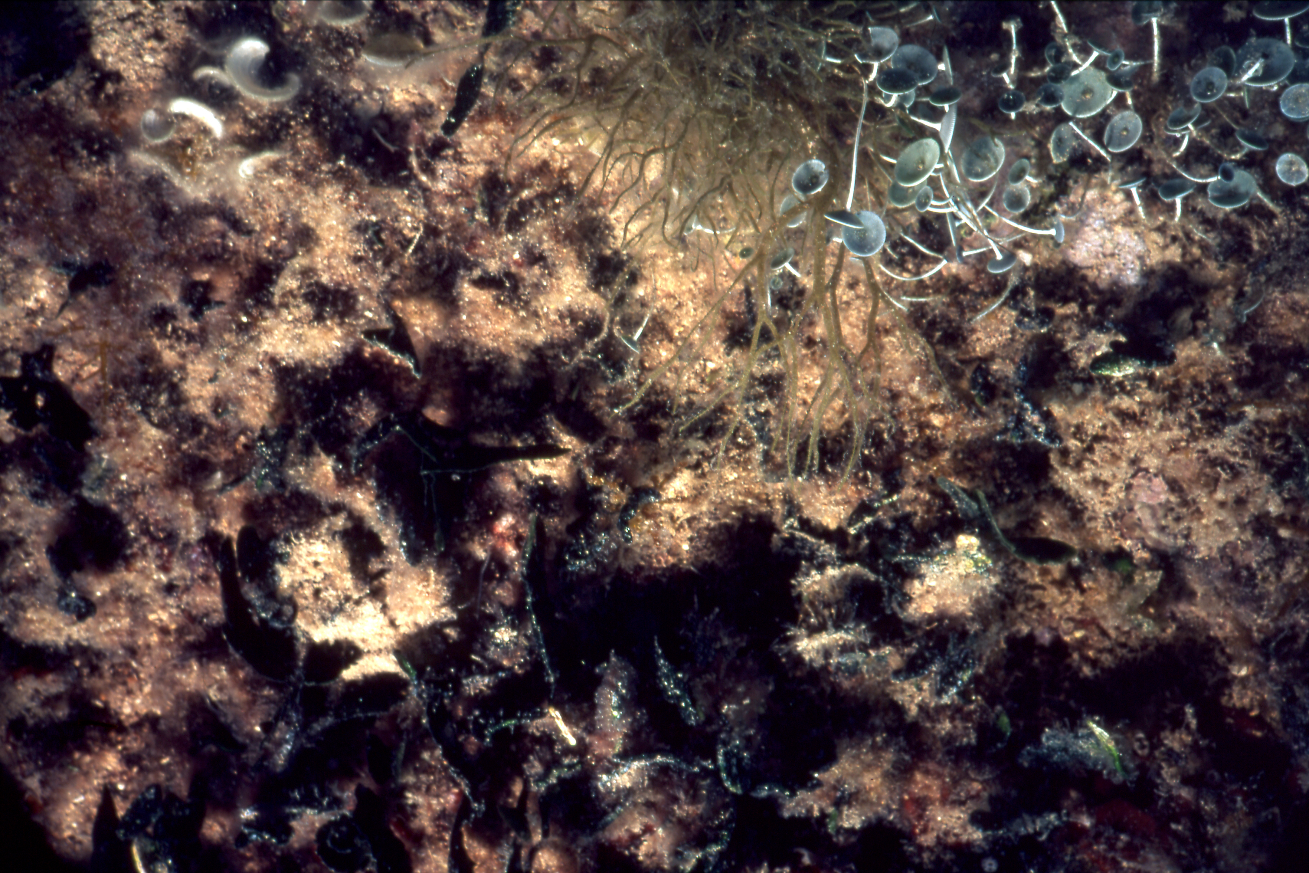
Evaluation of the effectiveness of Italian MPAs: the dataset consists of images from the digitization of the 2001 slides, taken during the project AFRODITE