 CNR-ISMAR
Format
Web Map Service
Type of resources
Available actions
Topics
INSPIRE themes
Provided by
Years
Formats
Representation types
Update frequencies
status
Scale
From
1
-
10
/
63
-
Sub-bottom chirp seismic profiles.
-
to be filled..
-

Boundaries of the Santa Maria Di Castellabate Marine Protected Areas (MPA).
-
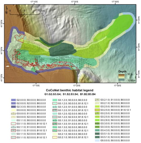
Volume of rock with distinct characteristics including depositional systems, systems tracts, relict units, and Undifferentiated substrate.
-
to be filled..
-
to be filled..
-
to be filled..
-
to be filled..
-
to be filled..
-

Contour lines derived from the EMODnet DTM 2018 every 10 meters water depth