2024
Type of resources
Available actions
Topics
INSPIRE themes
Provided by
Years
Formats
Representation types
Update frequencies
status
Scale
Resolution
-
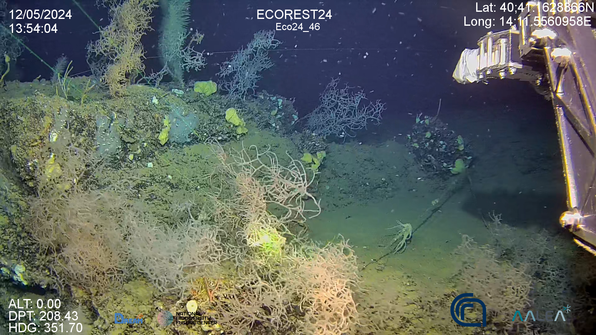
High resolution video on back corals forest in the Gulf of Naples (Italy)
-
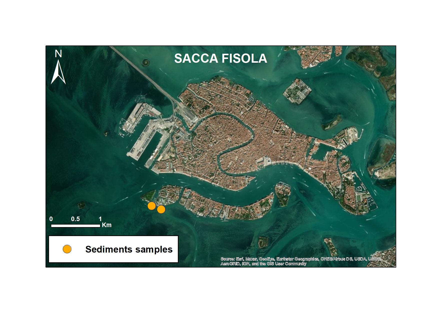
As part of the European MAELSTROM project, microplastic monitoring was carried out to assess the impact of marine cleaning operations. The study focused on two representative sites: Sacca Fisola, within the Venice Lagoon, characterised by high maritime traffic, and Mussel Farm, a coastal area near Cavallino-Jesolo, a former mussel farm. Both sites were monitored every six months and divided into before and after cleaning activities performed by the Seabed Robotic Cleaning Platform (autumn 2022 and spring 2023 for the Sacca Fisola site and spring 2023 for the Mussel Farm site). This innovative robotic system has been designed to remove macro-litter from the seabed. Monitoring also focused on surface sediments with the main objective of assessing the correlation between macro-litter removal and changes in MP concentrations in sediments.
-

As part of the European MAELSTROM project, microplastic monitoring was carried out to assess the impact of marine cleaning operations. The study focused on two representative sites: Sacca Fisola, within the Venice Lagoon, characterised by high maritime traffic, and Mussel Farm, a coastal area near Cavallino-Jesolo, a former mussel farm. Both sites were monitored every six months and divided into before and after cleaning activities performed by the Seabed Robotic Cleaning Platform (autumn 2022 and spring 2023 for the Sacca Fisola site and spring 2023 for the Mussel Farm site). This innovative robotic system has been designed to remove macro-litter from the seabed. Among the different matrices analysed, particular attention was paid to the biota, with the study of fish species representative of the North Adriatic area, both lagoon and coastal. The species analysed included mullet (Liza sp.), sea bream (Sparus aurata), dauphin (Atherina boyeri) and sole (Solea solea). The main objective was to assess whether the removal of macro plastics from the seabed by the robot was correlated with a reduction in microplastics in the fish themselves, thus contributing to an understanding of the effectiveness of cleaning operations not only on visible debris, but also on the microscopic particles that can be accidentally ingested by these organisms.
-
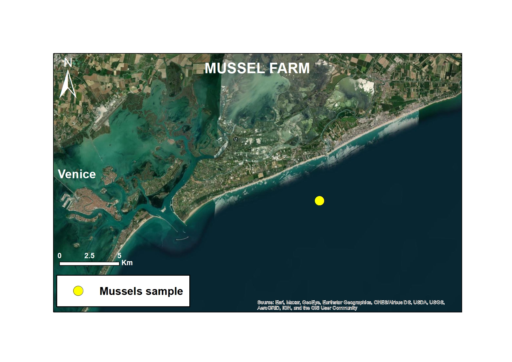
As part of the European MAELSTROM project, microplastic monitoring was carried out to assess the impact of marine cleaning operations. The study focused on two representative sites: Sacca Fisola, within the Venice Lagoon, characterised by high maritime traffic, and Mussel Farm, a coastal area near Cavallino-Jesolo, a former mussel farm. Both sites were monitored every six months and divided into before and after cleaning activities performed by the Seabed Robotic Cleaning Platform (autumn 2022 and spring 2023 for the Sacca Fisola site and spring 2023 for the Mussel Farm site). This innovative robotic system has been designed to remove macro-litter from the seabed.
-
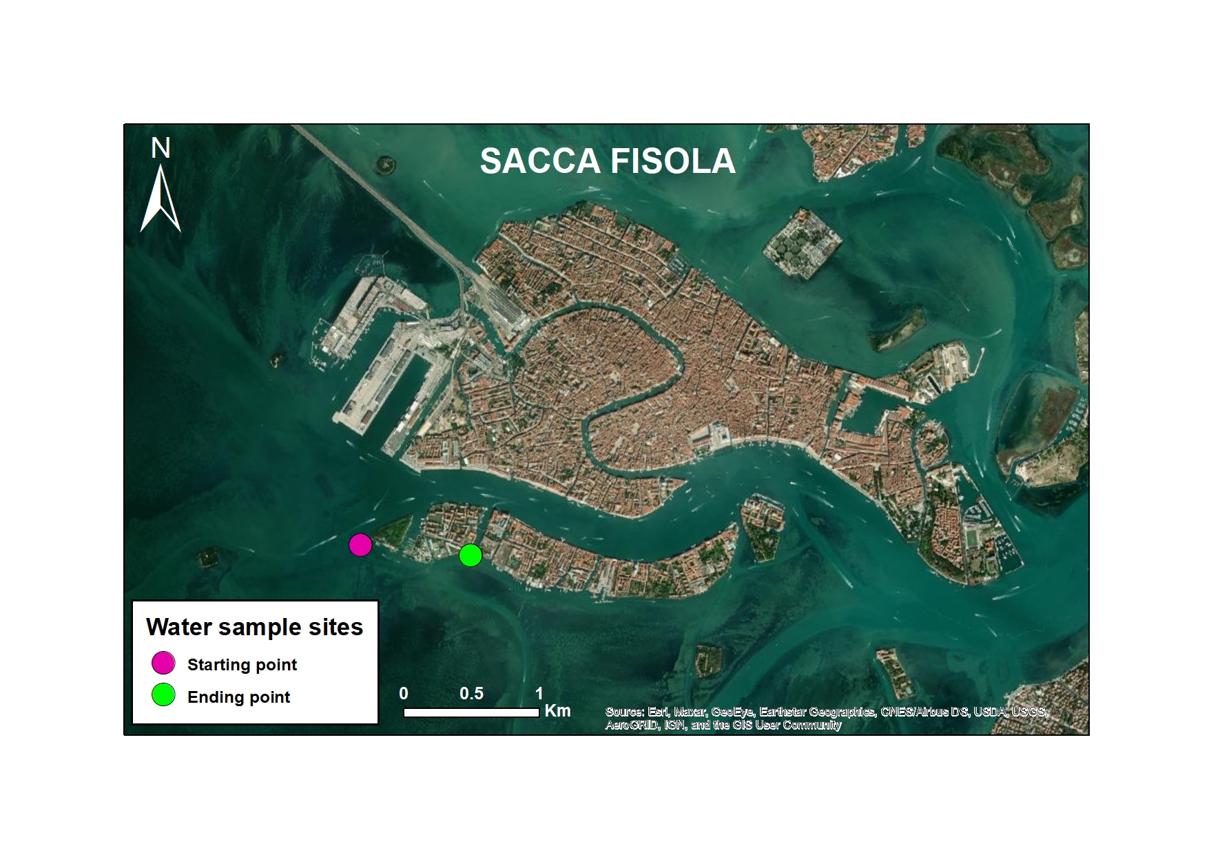
As part of the European MAELSTROM project, microplastic monitoring was carried out to assess the impact of marine cleaning operations. The study focused on two representative sites: Sacca Fisola, within the Venice Lagoon, characterised by high maritime traffic, and Mussel Farm, a coastal area near Cavallino-Jesolo, a former mussel farm. Both sites were monitored every six months and divided into before and after cleaning activities performed by the Seabed Robotic Cleaning Platform (autumn 2022 and spring 2023 for the Sacca Fisola site and spring 2023 for the Mussel Farm site). This innovative robotic system has been designed to remove macro-litter from the seabed. The main objective was to assess possible changes in the concentration of secondary MPs, which are particularly abundant in the marine environment, following clean-up operations. This approach represents an innovative contribution to the understanding of macro-litter-MP interactions and to the improvement of marine pollution mitigation strategies.
-

As part of the European MAELSTROM project, microplastic monitoring was carried out to assess the impact of marine cleaning operations. The study focused on two representative sites: Sacca Fisola, within the Venice Lagoon, characterised by high maritime traffic, and Mussel Farm, a coastal area near Cavallino-Jesolo, a former mussel farm. Both sites were monitored every six months and divided into before and after cleaning activities performed by the Seabed Robotic Cleaning Platform (autumn 2022 and spring 2023 for the Sacca Fisola site and spring 2023 for the Mussel Farm site). This innovative robotic system has been designed to remove macro-litter from the seabed. Monitoring also focused on surface sediments with the main objective of assessing the correlation between macro-litter removal and changes in MP concentrations in sediments.
-

As part of the European MAELSTROM project, microplastic monitoring was carried out to assess the impact of marine cleaning operations. The study focused on two representative sites: Sacca Fisola, within the Venice Lagoon, characterised by high maritime traffic, and Mussel Farm, a coastal area near Cavallino-Jesolo, a former mussel farm. Both sites were monitored every six months and divided into before and after cleaning activities performed by the Seabed Robotic Cleaning Platform (autumn 2022 and spring 2023 for the Sacca Fisola site and spring 2023 for the Mussel Farm site). This innovative robotic system has been designed to remove macro-litter from the seabed. The main objective was to assess possible changes in the concentration of secondary MPs in water surface, which are particularly abundant in the marine environment, following clean-up operations. This approach represents an innovative contribution to the understanding of macro-litter-MP interactions and to the improvement of marine pollution mitigation strategies.
-

As part of the European MAELSTROM project, microplastic monitoring was carried out to assess the impact of marine cleaning operations. The study focused on two representative sites: Sacca Fisola, within the Venice Lagoon, characterised by high maritime traffic, and Mussel Farm, a coastal area near Cavallino-Jesolo, a former mussel farm. Both sites were monitored every six months and divided into before and after cleaning activities performed by the Seabed Robotic Cleaning Platform (autumn 2022 and spring 2023 for the Sacca Fisola site and spring 2023 for the Mussel Farm site). This innovative robotic system has been designed to remove macro-litter from the seabed. Among the different matrices analysed, particular attention was paid to the biota, with the study of fish species representative of the North Adriatic area, both lagoon and coastal. The species analysed included mullet (Liza sp.), sea bream (Sparus aurata), spiny dogfish (Squalus acanthias) and sole (Solea solea). The main objective was to assess whether the removal of macro plastics from the seabed by the robot was correlated with a reduction in microplastics in the fish themselves, thus contributing to an understanding of the effectiveness of cleaning operations not only on visible debris, but also on the microscopic particles that can be accidentally ingested by these organisms.
-
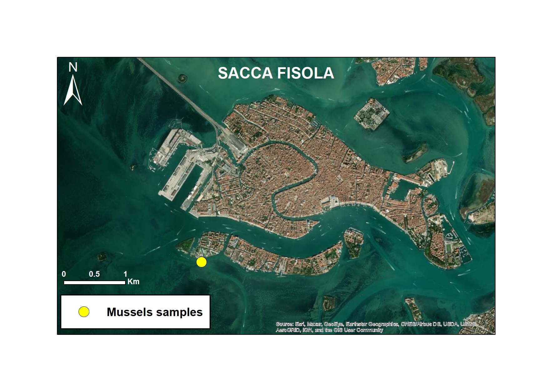
As part of the European MAELSTROM project, microplastic monitoring was carried out to assess the impact of marine cleaning operations. The study focused on two representative sites: Sacca Fisola, within the Venice Lagoon, characterised by high maritime traffic, and Mussel Farm, a coastal area near Cavallino-Jesolo, a former mussel farm. Both sites were monitored every six months and divided into before and after cleaning activities performed by the Seabed Robotic Cleaning Platform (autumn 2022 and spring 2023 for the Sacca Fisola site and spring 2023 for the Mussel Farm site). This innovative robotic system has been designed to remove macro-litter from the seabed. Among the matrices analysed, particular attention was paid to bivalves, which are used as bio-indicators. Several species, including Mytilus galloprovincialis, Magallana gigas and Ostreola stentina, were sampled to monitor the accumulation of microplastics (MP) in them. The main objective of the study was to assess whether the removal of macrolitter resulted in a reduction of microplastics in the environment.
-
Images taken with underwater camera from MPA Regno di Nettuno and MPA Banco di Santa Croce. Correlative experiment on Coralligenous reefs in the western Mediterranean in partnership with UNISS and UNIPA: Comparison of benthic community associated with Paramuricea clavata forests before and after water stratification period. Period: May-September 2023
 CNR-ISMAR