 CNR-ISMAR
Survey T71-IV
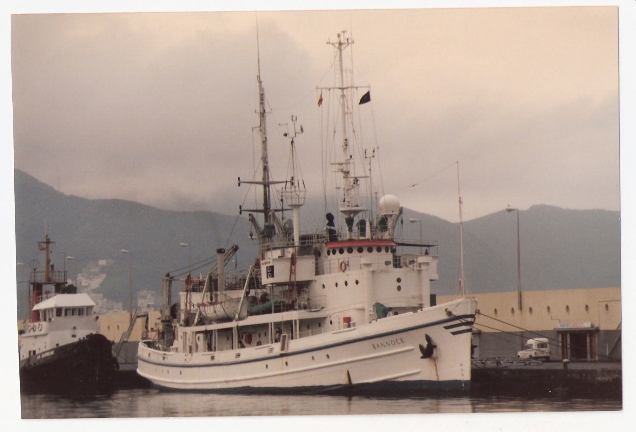
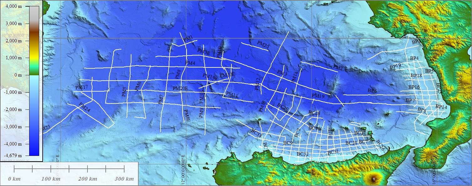
The survey has been carried out on board of the R/V Bannock - CNR. During the cruise, the main aim of which was the reconstruction of the geological and geodynamic evolution of the Tyrrhenian basin, a grid of single channel seismic profiles was collected using a 30 kJ - Sparker source (Teledyne Exploration, Houston - USA). From the original radio navigation system Loran-C, the coordinates have been later converted into geographical. The sparker profiles total 668,5 nm and are organized in groups named after the investigated areas. The areas investigated during the survey T71, Leg IV are: Cefalù Basin (seismic profiles T71-BC), Paola Basin Sapri Basin (seismic profiles T71-BP), and the most eastern Tyrrhenian abyssal plain (seismic profiles T71-PM). The cruise has been carried out from 1th November to 20th November 1971. P. Ferretti was part of the technical team. PI was the Dr. A. Fabbri.
Simple
- Date (Creation)
- 2020-11-13
- Presentation form
- Digital document
- Credit
- © CNR-ISMAR
- Status
- On going
- Maintenance and update frequency
- As needed
- Survey
-
- T71
- Survey type
-
- Geophysics
- Geology
- Seismic
- Device
-
- Sparker
- Gravity corer
- Piston corer
- Keywords
-
- oceanographic cruise
- seismic survey
- GEMET - INSPIRE themes, version 1.0
-
- Geology
- Natural risk zones
- Use limitation
- none
- Access constraints
- Other restrictions
- Other constraints
- Data policy of the project (link)
Resource constraints
No information provided.
- Use constraints
- Other restrictions
- Other constraints
- Data policy of the project (link)
- Classification
- Unclassified
- Metadata language
- Italiano
- Topic category
-
- Geoscientific information
N
S
E
W
))
- Supplemental Information
- Tyrrhenian Sea
- Distribution format
-
-
PDF
(
.pdf
)
-
PDF
(
.pdf
)
- Hierarchy level
- Non geographic dataset
- Other
- Report
Conformance result
- Date (Revision)
- 2020-11-13
- Explanation
- Validated in Geonetwork according to the ISO19115 rules (24/24)
- Pass
- Yes
- Statement
- The cruise report was produced in 1973
- File identifier
- a7a5d7cb-0708-4642-8013-8bc6a014b2ac XML
- Metadata language
- English
- Character set
- UTF8
- Hierarchy level
- Dataset
- Hierarchy level name
- Report
- Date stamp
- 2022-07-25T17:21:48
- Metadata standard name
- ISO 19115:2003/19139
- Metadata standard version
- 1.0
Overviews
Spatial extent
N
S
E
W
Provided by

Associated resources
Not available